|
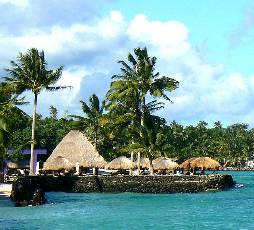
THE PACIFIC OCEAN
|
|||||||||||||||||||||||||||||||||||||||||||||||||||||||||||||||||||||||||||||||||||||||||||||||||||||||||||||||||||||||||||||||||||||||||||||||||||
|
BLUE
GROWTH - UN
FAO Asia and the Pacific's Blue Growth Initiative
Major areas of work of the regional initiative:
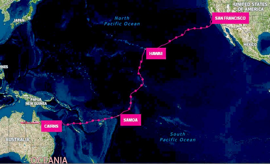
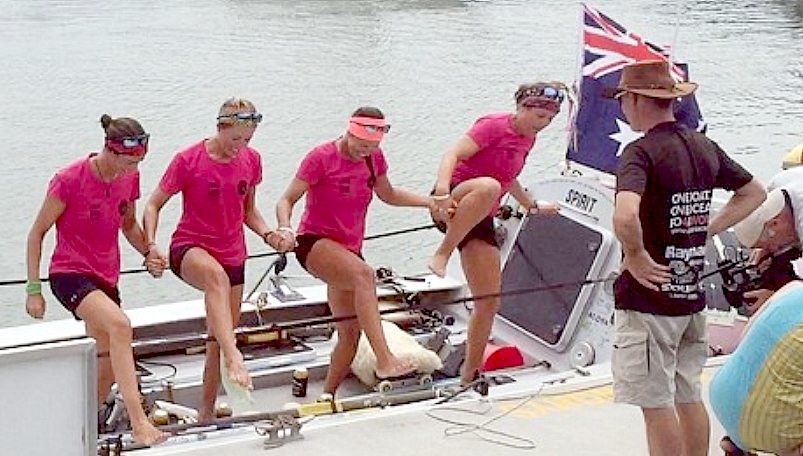
CNN JANUARY 25 - 4 BRITISH WOMEN ROW 8,000 MILES ACROSS THE PACIFIC OCEAN
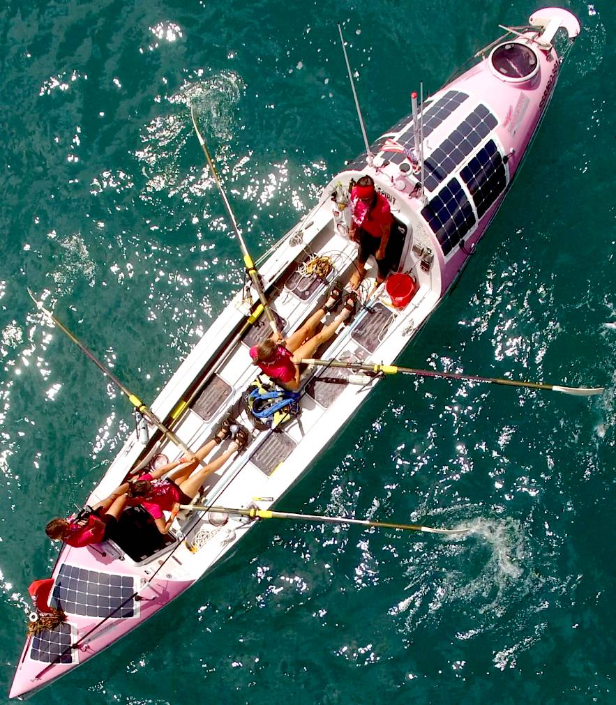
SHIFTS - Working in pairs, two on and two off, the ladies powered across the Pacific
With their arrival, Laura Penhaul, Natalia Cohen, Emma Mitchell and Meg Dyos
- the final leg rower - become the first four-person crew to row this trans-Pacific route, and the first team to do it in three stages, according to Walking With the Wounded, one of two British charities they are supporting. The team hopes to raise £250,000 ($356,000) for Walking With the Wounded and Breast
Cancer Care.
DORIS - Forget Shades of Grey, Shades of Pink is real life drama aboard a lively composite lifeboat only just big enough to carry food for part of the journey. This proved to be a risky strategy that caused friction on board. Rationing always sparks friction in any situation. But, in confined quarters one release of pent up concerns is to vent some steam on a fellow passenger. No harm done. It is healthy to be able to let go now and again and still remain friends. The real test comes when there is no food for months. Then a friend can begin to look like nourishment.
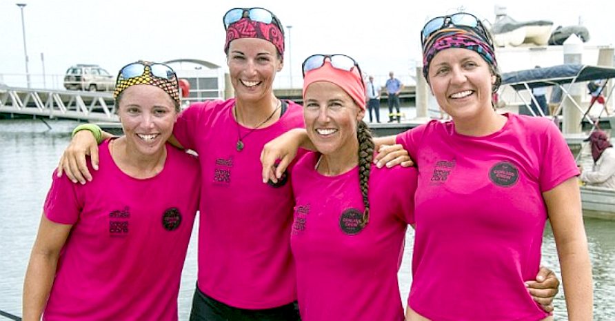
ONE SMALL STEP FOUR WOMEN - One giant leap into the record books. They did it, with huge thanks to all their supporters.
ACTION - The cameras roll as the ladies are officially welcomed to Australia.
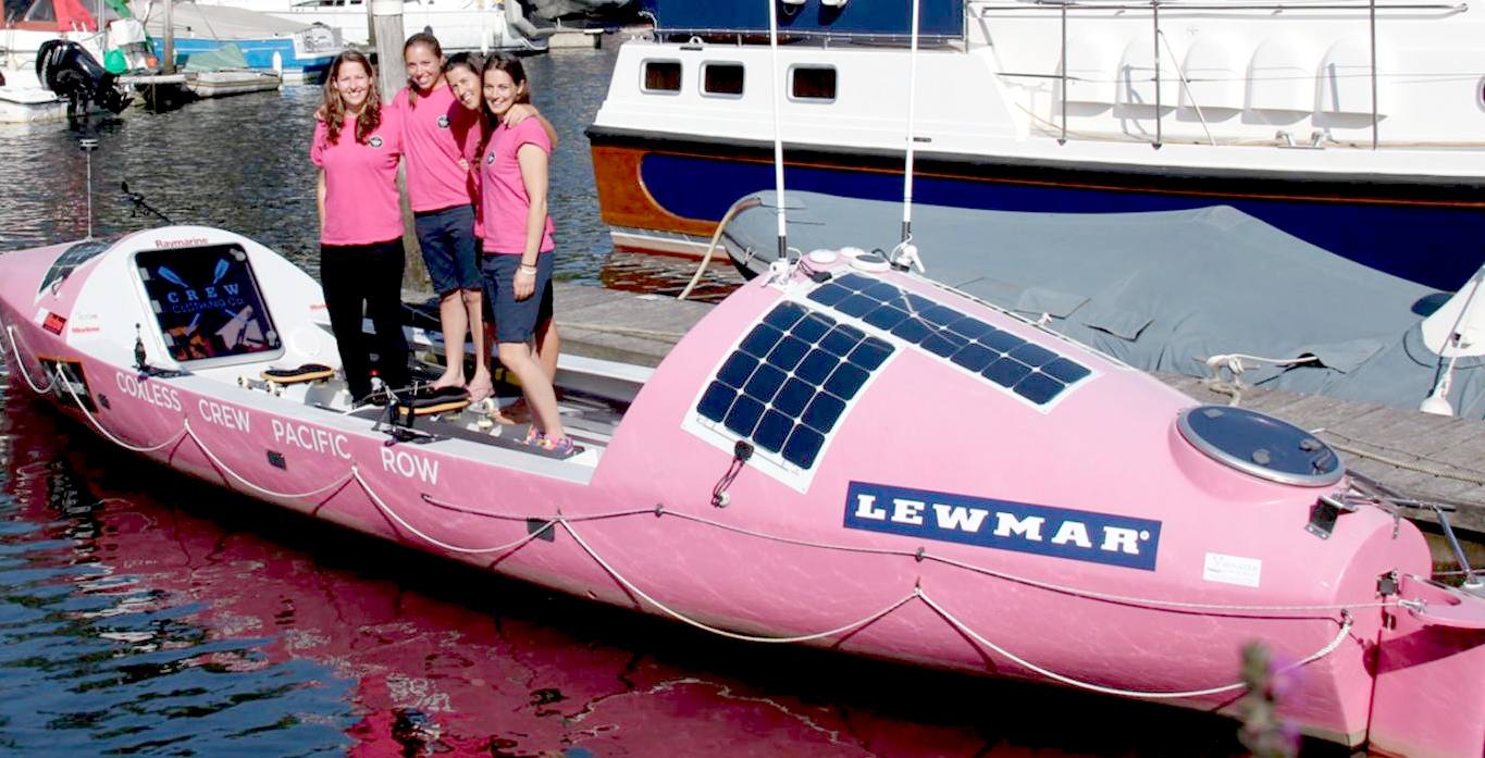
FRIENDS - Back on terra firma the girls are just happy to have made it in time to catch some noodles at a local bistro.
The rowers have been videotaping their journey, and that footage will be part of a documentary "Losing Sight of Shore" by filmmaker Sarah Moshman.
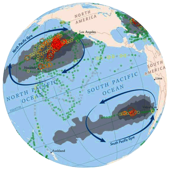
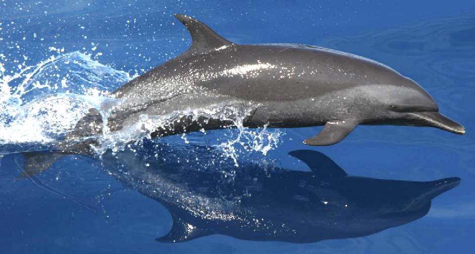
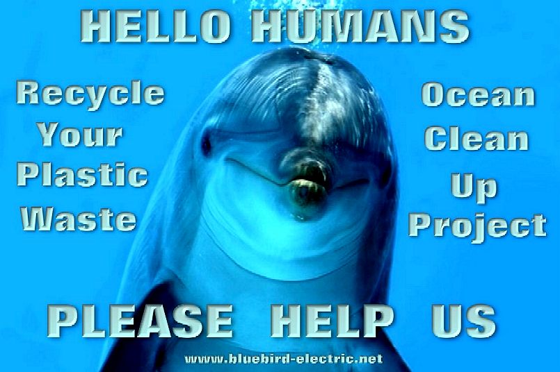
A Pacific spotted dolphin, under threat from toxin build up in plastic pollution in the Great North Pacific Garbage Patch. See our vision for a sustainable world future here.
Sometimes that drama involved minor irritations between the crew members, Cohen said.
"The main one that comes to mind was between me and Laura, where we argued over a packet of instant noodles," she said.
COXLESS CREW PACIFIC RECORD SPONSORS
PACIFIC FACTS
The Pacific Ocean is the largest of the Earth's oceanic divisions. It extends from the Arctic in the north to the Southern Ocean (or, depending on definition, to Antarctica) in the south, bounded by Asia and Australia in the west, and the Americas in the east.
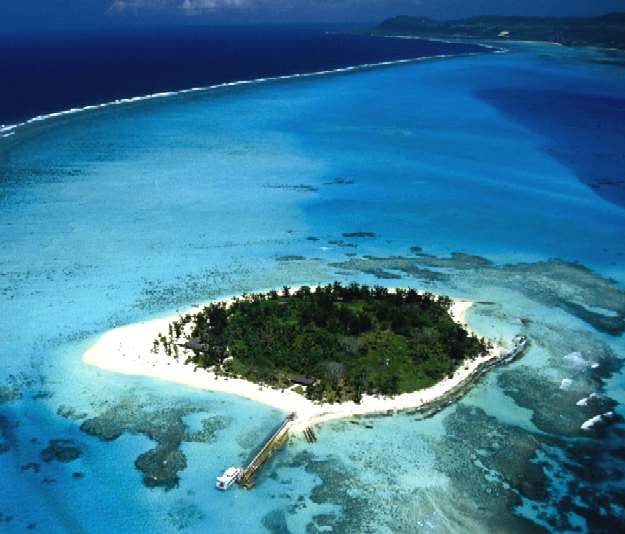
PALAU ISLANDS - Is seen here as a peak in the ocean in the middle of this map. This was the world's first marine sanctuary for sharks from 2009, with President "Tommy" Remengesau setting the example for others to follow.
SEAWATER CHARACTERISTICS
The volume of the Pacific Ocean, representing about 50.1 percent of the world's oceanic water, has been estimated at some 680 million cubic miles (2.8 billion cubic kilometres). Surface water temperatures in the Pacific can vary from −1.4 °C (29.5 °F), the
freezing point of sea water, in the poleward areas to about 30 °C (86 °F) near the equator. Salinity also varies latitudinally reaching a maximum of 37 parts per thousand in the southeastern area. The water near the equator, which can have a salinity as low as 34 parts per thousand, is less salty than that found in the mid-latitudes because of abundant equatorial precipitation throughout the year. The lowest counts of less than 32 parts per thousand are found in the far north as less evaporation of seawater takes place in these frigid areas. The motion of Pacific waters is generally clockwise in the Northern Hemisphere (the North Pacific gyre) and counter-clockwise in the Southern Hemisphere. The North Equatorial Current, driven westward along latitude 15°N by the trade winds, turns north near the Philippines to become the warm
Japan or Kuroshio Current.
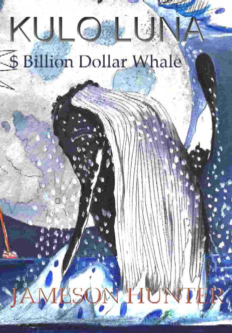
Chapter 20 - EMPTY OCEAN 200 N, 1600 E (extract from: The $Billion Dollar Whale by Jameson Hunter © 2014)
Coverage of the ‘Lost Whale’ story was extraordinary, being featured on or near the front pages of almost every newspaper and popular magazine. By contrast the Solar Navigation Challenge, which only a few days earlier had been headline news, had been relegated to deep within the inside pages and was no longer a daily featured update for television. “Steve!”
Yelled Charley, as she burst into their hotel room. Steve was standing on
the balcony, taking in the panoramic view. “You
realise we’ve already more than recovered our investment on the solar
race?” “Never mind that, take a look at these papers.” Charley
spread half a dozen top papers on the marble floor. Steve came inside to a
carpet of news. “Blow
me down,” he puffed, “impressive stuff.” There
were full front page pictures of Humpback Whales broaching, and a couple
of illustrations of ‘Moby Dick’ style artists impressions. “Do
you realise what the first pictures of Kulo will command?” They
spent a good hour looking over the copy to judge the reception of the
story and to decide how best to aim the coverage to come. The anticipation
made their blood and minds race. Then they checked on the internet
editions. Nothing was showing. Good,
thought Charley. Not quite the same
as the smell of good old fashioned hot, hard copy anyway. But, the
days of print were limited. They all knew it and had to move with the
times, or drown. Steve decided to call Sky for feedback. “Afternoon
Tom, we’ve just read your latest networked editorials – bloody good,
but the pressure is on us now to find this poor animal before anyone else.” “That’s
what I’m counting on,” said Tom. “Listen, this was your idea, not
mine. I just agreed to help. You realise we’ve syndicated the story as a
high priority rescue, to just about every press agency?” “Yes,
much appreciated, in fact I’m treading on a sample right now. “Well,
let us know of any clues, the moment you get them. Sorry old chum must
dash; bye for now.” The line went dead. Tom was a very busy man. He wasn’t
being rude. Steve
paced the room for a few seconds, and then put the phone to his ear again.
The connection took a few minutes, so Charley knew who he was calling –
ship to shore. “Hi,
John …… how’s the race going? ………” John
was way ahead of Starlight, and Starlight was way ahead of the pack, both
boats enjoying cruising toward the Equator in ideal conditions. Dan
looked at John, “Who’s that?” John
mouthed “It’s Steve.” Then continued his conversation. “Hey
Steve, good to hear from you. Do you want a position report?” “Oh
yah, of course.” “Were
about two thousand nautical miles from Oahu and a few hundred in the lead.
It looks like Starlight is also quite a bit ahead of the rest. Dan says
hi.” “Oh, hi back to Dan. John, I was wondering if you’ve spotted anything out of the ordinary in your travels?” “No,
should I be looking out for anything?” Steve
knew the news had not yet reached them. “No, but stay alert just in
case. Catch you later.” “Okay,
later. Out.” That
worried John. He knew there was more to it than that. Damn, he hated it
when that sort of thing happened. Stay alert to what? He checked the radar
- nothing. He tuned to the international distress frequency – nothing. “Steve
says hi.” Dan could tell John was not entirely happy with that call, but
said nothing. ……. It was kind of quiet. Dan was expecting contact from
the media at more or less regular intervals. “Dan,
keep a listen out for any news, will you.” “Is
that what that call was about?” “No,
not really, but yes maybe. I’m not sure. I’ve a feeling something is
up – a hunch.” John’s hunches had a habit of being right, so Dan switched on the news channels and kept the radio scanning emergency channels.
- * -
PACIFIC OCEAN GEOGRAPHY The Pacific separates Asia and Australia from the Americas. It may be further subdivided by the equator into northern (North Pacific) and southern (South Pacific) portions. It extends from the Antarctic region in the South to the Arctic in the north. The Pacific Ocean encompasses approximately one-third of the Earth's surface, having an area of 165.2 million square kilometres (63.8 million square miles) — significantly larger than Earth's entire landmass of some 150 million square kilometres (58 million square miles).
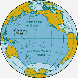
Extending approximately 15,500 kilometres (9,600 mi) from the Bering Sea in the Arctic to the northern extent of the circumpolar Southern Ocean at 60°S (older definitions extend it to Antarctica's Ross Sea), the Pacific reaches its greatest east-west width at about 5°N latitude, where it stretches approximately 19,800 kilometres (12,300 mi) from Indonesia to the coast of Colombia – halfway across the world, and more than five times the diameter of the Moon. The lowest known point on Earth - the Mariana Trench - lies 10,911 metres (35,797 ft or 5,966 fathoms) below sea level. Its average depth is 4,028~4,188 metres (14,000 ft or 2,333 fathoms).
Due to the effects of plate tectonics, the Pacific Ocean is currently shrinking by roughly an inch per year (2–3 cm/yr) on three sides, roughly averaging 0.2 square miles (0.52 km2) a year. By contrast, the Atlantic Ocean is increasing in size.
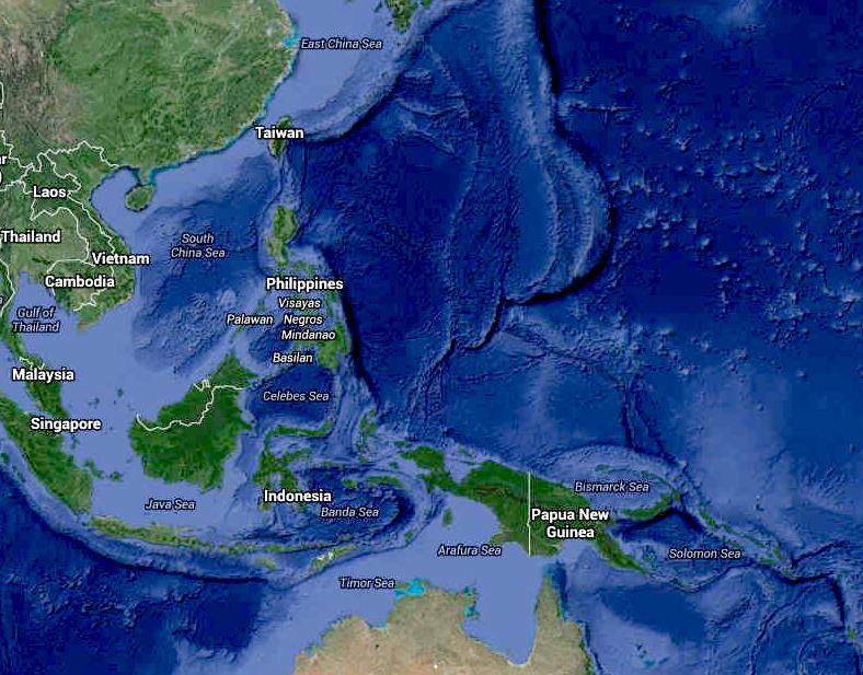
Along the Pacific Ocean's irregular western margins lie many seas, the largest of which are the Celebes Sea, Coral Sea, East China Sea, Philippine Sea, Sea of Japan, South China Sea, Sulu Sea, Tasman Sea, and Yellow Sea. The Strait of Malacca joins the Pacific and the Indian Oceans on the west, and Drake Passage and the Strait of Magellan link the Pacific with the Atlantic Ocean on the east. To the north, the Bering Strait connects the Pacific with the Arctic Ocean.
As the Pacific straddles the 180th meridian, the West Pacific (or western Pacific, near Asia) is in the Eastern Hemisphere, while the East Pacific (or eastern Pacific, near the Americas) is in the Western Hemisphere.
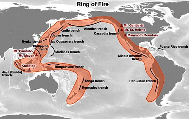
For most of Magellan's voyage from the Strait of Magellan to the Philippines, the explorer indeed found the ocean peaceful. However, the Pacific is not always peaceful. Many tropical storms batter the islands of the Pacific. The lands around the Pacific Rim are full of volcanoes and often affected by earthquakes. Tsunamis, caused by underwater earthquakes, have devastated many islands and in some cases destroyed entire towns.
Around the Pacific Ocean is a region known as the Ring of Fire, where a large number of earthquakes and volcanic eruptions occur that may have been the origin of glow. The horseshoe shape is 25,000 miles (40,000 km) and, with 452 volcanoes, is home to more than 75 per cent of the planet's active and dormant volcanoes
LAND MASSES & ISLANDS
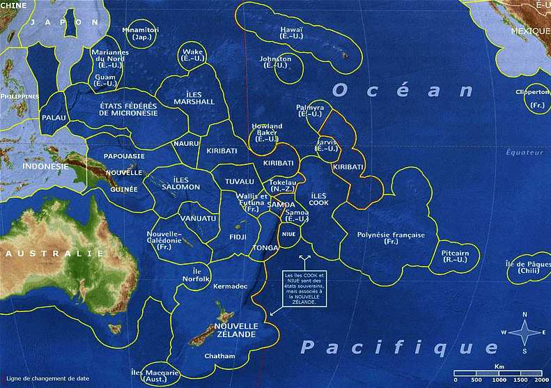
The islands entirely within the Pacific Ocean can be divided into three main groups known as Micronesia, Melanesia and Polynesia. Micronesia, which lies north of the equator and west of the International Date Line, includes the Mariana Islands in the northwest, the Caroline Islands in the centre, the Marshall Islands to the west and the islands of Kiribati in the southwest.
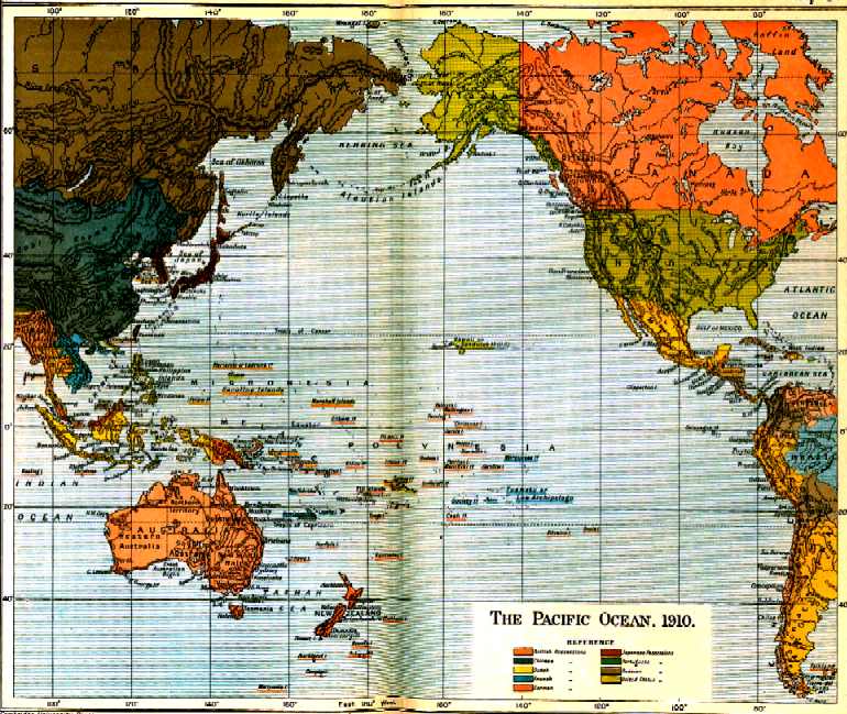
An old map of the Pacific Ocean compared to a modern version showing the islands
GEOLOGY
The ocean
was mapped by Abraham Ortelius; he called it Maris Pacifici because of
Ferdinand
Magellan, who sailed the Pacific during his circumnavigation from 1519
to 1522 and said that it was much more calm than the Atlantic.
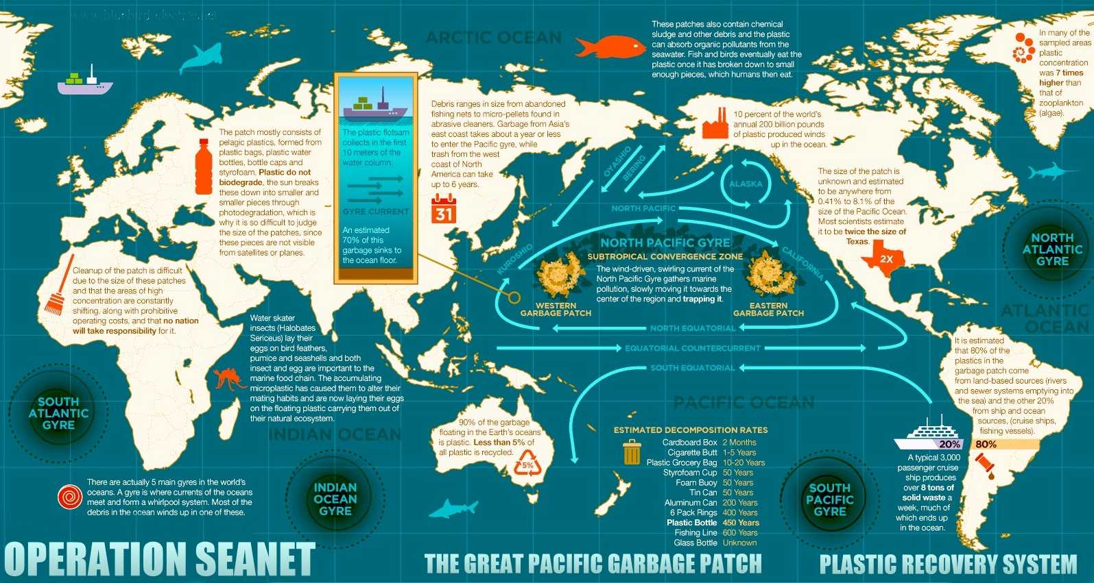
Oil and plastic pollution totaling some 270,000 tons of waste in five major ocean gyres, is killing life in the oceans and poisoning our food chain. Dolphins, Seals and Turtles that have been trapped by plastic bags, nets and the like are common sights. These animals cannot clean the oceans up themselves. They need the help of the humans that caused the problem, turning their habitat into a convenient 'out of sight' rubbish dump.
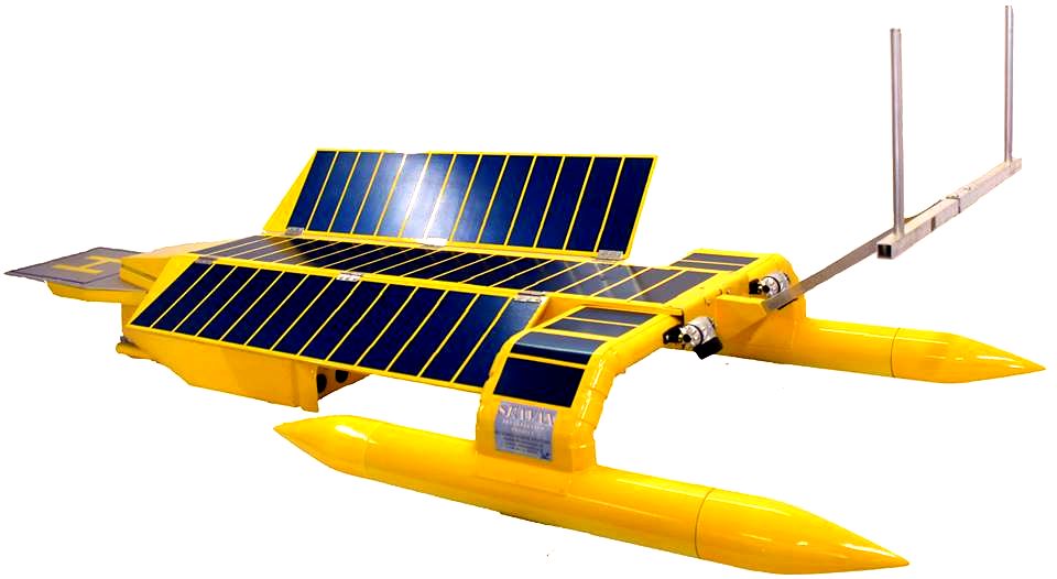
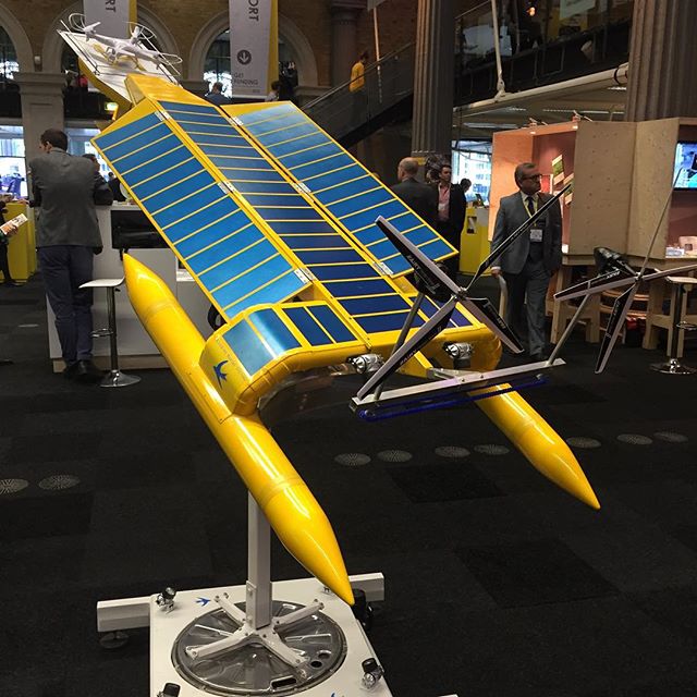
Adapted Bluefish ZCC semi-autonomous drones could clean up the oceans for us in just a decade, if funding can be sourced to kickstart such a challenging project. Bluebird Marine Systems are not fund raising for the proposed clean-up project, rather leaving this to those better qualified. BMS are though able to develop prototypes in-house to be able to prove concepts, and arrange for subcontracting specialists to build ocean going cleaners that do not add to the carnage, because they are themselves zero emission, solar and wind powered high performance vehicles. We are prepared to work on research projects such as these on a not-for-profit basis in collaboration with other agencies and organizations.
The North Pacific gyre is just one of several swirling trash zones (gyres) in our oceans, and it's where a lot of our plastic litter ends up. While these debris patches aren't visible piles of floating trash in the water, they are inverted mountains - a bit like landfill sites at sea - hidden from view. The reality of what they are and how they got there is mind boggling and extremely harmful to marine life. We can't (at the moment) do much about nuclear waste in the oceans (except appeal to reason), but we can act to vacuum up solids.
The Pacific North and South Oceans are the world's largest water mass, 165,200,000 km² with a mean depth of 4,280m
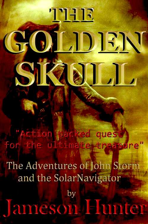
LORD
HUNTINGTON - a prominent member of the British Geographical Society, acquires an ancient parchment on the deathbed of a famous explorer, handed down through
generations, father to son, which contains clues to the location of pirate,
Henry
Morgan's accumulated treasure trove on an Island in the Caribbean, said to be guarded by a macabre human spirit manifesting itself as human skull. More to the point these islands are patrolled by the US and South American navies who are in a cold war situation.
ACIDIFICATION - ADRIATIC - AEGEAN - ARCTIC - ATLANTIC - BALTIC - BAY BENGAL - BAY BISCAY - BERING - BLACK - CARIBBEAN - CORAL - EAST CHINA - ENGLISH CH - FINLAND - GOC - GULF GUINEA - GULF MEXICO - GULF THAILAND - GULF TONKIN - INDIAN - IONIAN - IOC - IRC - IRISH - MEDITERRANEAN - NORTH SEA - PACIFIC - PERSIAN GULF RED SEA - SEA JAPAN - STH CHINA - PLASTIC - PLANKTON - PLASTIC OCEANS - RED - SARGASSO - SEA LEVEL RISE - SOUTHERN OCEAN - TYRRHENIAN - UNCLOS - UNEP WOC - WWF
AMAZON - BURIGANGA - CITARUM - CONGO - CUYAHOGA - GANGES - IRTYSH - JORDAN - LENA - MANTANZA-RIACHUELO MARILAO - MEKONG - MISSISSIPPI - NIGER - NILE - PARANA - PASIG - SARNO - THAMES - YAMUNA - YANGTZE - YELLOW - ZHUJIANG
LINKS & REFERENCE
Daily Mail Mystery-glow-Pacific-Ocean-Pilots-left-baffled-strange-orange-red-lights-spotted-dead-night Reuters US-space-spacex-station splash down http://www.fao.org/asiapacific/perspectives/blue-growth/en/ http://www.britannica.com/EBchecked/topic/437703/Pacific-Ocean http://www.reuters.com/article/2014/10/25/us-space-spacex-station-idUSKCN0IE0J620141025 http://en.wikipedia.org/wiki/Marine_pollution hhttp://edition.cnn.com/2016/01/25/sport/british-rowers-pacific-ocean/ http://en.wikipedia.org/wiki/Pacific_Ocean http://www.enterprise-europe-scotland.com/sct/news/?newsid=4538 http://en.wikipedia.org/wiki/International_Convention_for_the_Safety_of_Life_at_Sea
SEAVOLUTION - The key to healthy oceans is continuous monitoring and constant plastic patrols, for which the SeaVax ZCC (Zero Carbon Cruiser or ZEWT) platform, a concept that was under development until 2020, is a robotic ocean workhorse. The SeaVax concept is based on a stable trimaran hull this design is under development in the UK, looking to expand into the US. The robot ship uses no diesel fuel to monitor the oceans autonomously (COLREGS compliant) 24/7 and 365 days a year - only possible with the revolutionary (patent) energy harvesting system. The hullform is ideal for automatic release and recovery of ROVs or towed arrays, alternating between drone and fully autonomous modes. International development partners are welcome, We are not at this time bound by contract to any one country. This vessel would pay for itself in fuel saved every ten years. This ZCC would make an ideal fleet to clean up large areas of oceans, such as the plastic gyre garbage patches that the UN are concerned about.
|
|||||||||||||||||||||||||||||||||||||||||||||||||||||||||||||||||||||||||||||||||||||||||||||||||||||||||||||||||||||||||||||||||||||||||||||||||||
|
This webpage is Copyright © 2024 Bluebird Marine Systems Ltd. The names AmphiMax™, Bluebird™, Bluefish™, Miss Ocean™, SeaNet™, SeaVax™ and the blue bird & fish
logos are trademarks. All other trademarks are hereby acknowledged.
|
|||||||||||||||||||||||||||||||||||||||||||||||||||||||||||||||||||||||||||||||||||||||||||||||||||||||||||||||||||||||||||||||||||||||||||||||||||