CANNONBALL
INTERNATIONAL EV SERIES
The
Cannonball International EV Run™ series is for battery or hydrogen
fuel cell powered
electric vehicles that are based on ordinary production vehicle running
gear and must be capable of carrying at least one passenger. They may be solar
assisted, provided that the solar panel area does not exceed four square
meters - a rule that may be relaxed in subsequent years as we learn from experience. See
the full Cannonball EV rules HERE.
These
rules are designed to promote the development of an international EV infrastructure, as a means of accelerating the transition from
IC
engines to clean electric motors, or other zero emission transportation, especially in countries that do not
have abundant sunshine, where support for non-solar assisted
electric vehicles is all the more important.

Make
sure that you read the EV runners road rules before entering your
team. Each person completing a recognized run will receive a Blue
Riband eco medal. The competitor with the highest scores overall in
any one year will have their name inscribed on the Bluebird
World Cup.
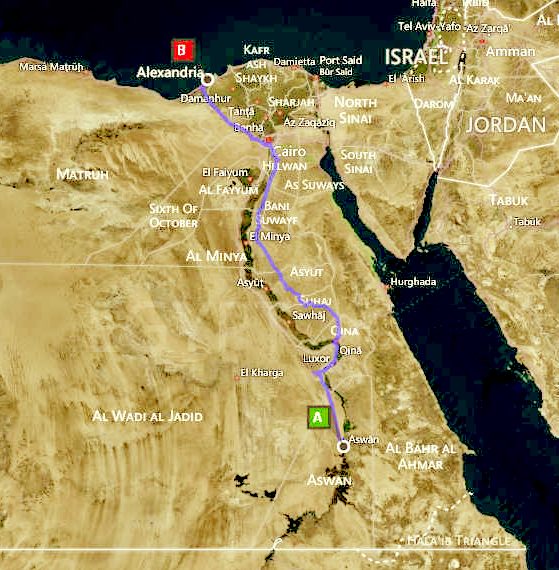
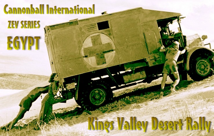
EGYPTIAN KINGS
VALLEY RALLY: ASWAN to ALEXANDRIA CANNONBALL RUN SUGGESTED STOPS @ 50mph AVE
|
START
|
ASWAN
|
MILES
RUN
|
LEG
DISTANCE
|
KM
RUN
|
HOURS
|
|
|
|
|
56
|
|
|
|
1st
STOP
|
Al
Madiq
|
35
|
+
|
56
|
.70
|
|
|
|
|
147
|
|
|
|
2nd
STOP
|
Luxor
|
126
|
+
|
203
|
2.52
|
|
|
|
|
116
|
|
|
|
3rd
STOP
|
Farshut
|
198
|
+
|
319
|
3.96
|
|
|
|
|
126
|
|
|
|
4th
STOP
|
Tahta
|
277
|
+
|
445
|
5.54
|
|
|
|
|
121
|
|
|
|
5th
STOP
|
Al
Habalsa
|
352
|
+
|
566
|
7.04
|
|
|
|
|
112
|
|
|
|
6th
STOP
|
Minya
|
421
|
+
|
678
|
8.42
|
|
|
|
|
155
|
|
|
|
7th
STOP
|
Ad
Diybiyyah
|
518
|
+
|
833
|
10.36
|
|
|
|
|
118
|
|
|
|
8th
STOP
|
Cairo
|
591
|
+
|
951
|
11.82
|
|
|
|
|
197
|
|
|
|
FINISH
|
ALEXANDRIA
|
714
|
|
1,148
|
14.28
|
BING
MAPS SUGGESTED ROUTE - Driving directions
for a 20 HR target with cartridge exchange and 30 hours with fast charging (This route has tolls).
Please note that there are no fast charging points along this route
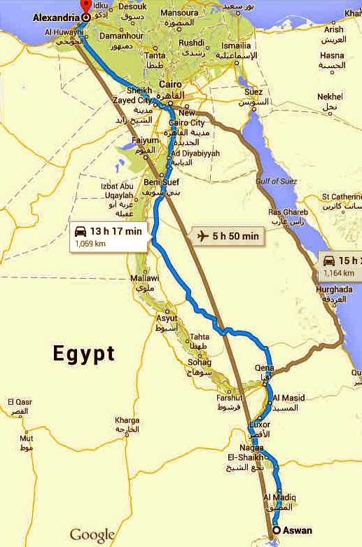
that we know of. Hence, bank on at least 30 hours with slow charging. The
Google route planner time of shows less distance 13 hour 17 minutes,
that is for an average
speed of 53.6 mph. Clearly, a target speed that is achievable for
many EVs that may be suitable as budget entrant vehicles.
ASWAN
GOVERNORATE - Egypt
Take Al Hadadin and Al Matar to Kornish Al Nile
- 1.0 km / 3 min, Head north 30 m
Turn left toward Al Dawi
- 5 m, Take the 1st right onto Al Dawi - 81 m
Take the 1st left
- 140 m, Turn right onto Al Hadadin - 230 m, Turn left onto Al Matar -
500 m
Follow Cairo - Aswan Rd/Route 02 to El Geesh St/طريق الصعيد البحر الأحمر - وصلة قنا in Red Sea Governorate
-289 km / 3 h 52 min
Turn right onto Kornish Al Nile - 850 m, At the roundabout, take the 1st exit and stay on Kornish Al Nile
- 1.8 km
Slight right toward Cairo - Aswan Rd/Saleh Mohammed Hasan Al Mohami/Route 02
- 210 m
Slight left toward Cairo - Aswan Rd/Saleh Mohammed Hasan Al Mohami/Route 02
- 36 m
At the roundabout, take the 3rd exit onto Cairo - Aswan Rd/Saleh Mohammed Hasan Al Mohami/Route 02
- 9.1 km
At the roundabout, take the 1st exit and stay on Cairo - Aswan Rd/Saleh Mohammed Hasan Al Mohami/Route 02,
Continue to follow Cairo - Aswan Rd/Route 02 - 94.2 km
Sharp left to stay on Cairo - Aswan Rd/Route 02 - 168 km
Turn right onto Msnaa Al Ghzle Al a Ezba Al Bosa - 3.5 km, Continue onto Masnaa Al Ghazaly - Ezbet Al Bosa
- 280 m
Turn left to stay on Masnaa Al Ghazaly - Ezbet Al Bosa - 43 m
Slight right onto Nagaa Hamadi - Aswan 0 1.0 km, Continue onto Qena - Safaga Rd
- 8.4 km
Slight left toward Qena - Safaga Rd - 110 m. Slight left onto Qena - Safaga Rd
- 1.0 km
Take El Geesh - Souhag - Qena Rd to طريق الصعيد البحر الأحمر
- 154 km / 1 h 51 min
Slight right onto El Geesh St/طريق الصعيد البحر الأحمر - وصلة قنا
- 47.1 km
At the roundabout, take the 2nd exit onto El Geesh - Souhag - Qena Rd
- 82.4 km
Slight right - 24.9 km, Continue on طريق الصعيد البحر الأحمر. Take Al Kurimat - Al Zafrana Rd, Cairo - Aswan Rd/Route 02 and Cairo - Alexandria Desert Rd to Suez Canal Rd in Alexandria
- 614 km / 7 h 29 min
Continue onto طريق الصعيد البحر الأحمر -
245 km
Continue onto Al Kurimat - Al Zafrana Rd
- 44.5 km, Take the exit - 450 m
At the roundabout, take the 1st exit - 350 m, At the roundabout, take the 2nd exit
- 160 m
Slight right - 4.2 km, Turn right onto Al Menia - Al Wosta/Cairo - Aswan Rd/Route 02
Continue to follow Cairo - Aswan Rd/Route 02
- 14.3 km
Slight left onto Al Kurimat - Al Zafrana Rd
- 180 m
Continue onto Al Karimat - Kafr Al Dasmi/Cairo - Aswan Rd/Route 02 - 5.9 km
At the roundabout, take the 1st exit and stay on Al Karimat - Kafr Al Dasmi/Cairo - Aswan Rd/Route 02,
Continue to follow Cairo - Aswan Rd/Route 02 - 52.3 km
Turn right onto Al Marazeek Bridge - 2.4 km, Slight rt to stay on Al Marazeek Bridge
- 110 m
Slight right onto Cairo - Aswan Agriculture Rd/Mzghona- Al Marazeek Rd
Continue to follow Cairo - Aswan Agriculture Rd
- 23.3 km
Continue onto Al Bahr Al Aazam - 800 m, Slight right to merge onto Ring Rd
- 9.9 km
Take the exit on the left to stay on Ring Rd - 2.7 km, Keep left to stay on Ring Rd
- 2.4 km
Take the ramp onto Sahara El Ahram,
2.9 km, Keep left - 700 m
Merge onto Cairo - Alexandria Desert Rd
- 198 km
Continue straight to stay on Cairo - Alexandria Desert Rd
- 3.6 km
Follow Suez Canal Rd and Ahmed Ismail to Ahmed Zoayl Sq. in Bab Sharqi WA Wabour Al Meyah
- 450 m / 1 min.
ALEXANDRIA
GOVENORATE - Egypt
OFFICIAL
CANNONBALL INTERNATIONAL ZEV ROUTES
|
Arabia
- Jeddah to Dubai
Australia
- Darwin to Adelaide
Brazil
- Boa Vista to Rio de Janeiro
Canada
- Vancouver to Quebec
China
- Ai
Hui
Qu to Shenzen
Denmark
- Skagen to Copenhagen
Egypt
- Kings Valley Rally - Aswan to Alexandria
France
- Calais to Toulon
Germany
- Bremerhaven to Munich
India
- Amritsar to Nagercoil
Italy
- Turin to Reggio Calabria
|
Japan
- Aomori to Kagoshima
Korean
S. Smart City Rally - Seoul to Busan
New
Zealand - Nelson to Invercargill
Nigeria
- Maiduguri to Lagos
Norway
- Bodø to Kristiansand
Russia
- Murmansk to Bolshoy
Sochi
South
Africa - Cape Town to Louis
Trichardt
Spain
- Girona to Huelva
Sweden
- Karlsborg to Gothenburg
UK
- John o'Groats to Lands End (Jogle)
USA
- Los Angeles to New York
|
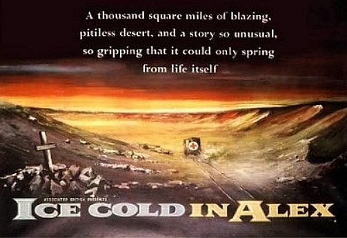
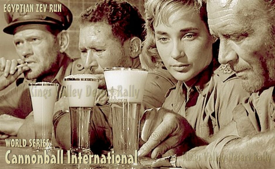
ICE
COLD IN ALEX
This
is one of our all time favourite
movies. Ice Cold in Alex (1958) is a British film based on the novel of the same name by British author Christopher Landon, and described as
based on a true story in the film's opening credits. Directed by J. Lee Thompson and starring John Mills, the film was a prizewinner at the 8th
Berlin International Film Festival.
MOVIE PLOT
A British unit at Tobruk is attacked by the German Afrika Korps in the Western Desert Campaign of World War II. During the resulting evacuation, Captain Anson (John Mills), a transport pool officer suffering from battle fatigue and alcoholism, MSM Tom Pugh (Harry Andrews) and two nurses – Diana Murdoch (Sylvia Syms) and Denise Norton (Diane Clare) – crew an
Austin K2/Y ambulance, nicknamed 'Katy', and decide to drive across the desert back to British lines.
As they depart they come across an Afrikaner South African officer, Captain van der Poel (Anthony Quayle), who carries a large pack, to which he seems very attached. After the South African shows Anson two bottles of gin in his back pack, van der Poel persuades Anson to let him join them in their drive to the safety of the British lines in Alexandria, Egypt.
Anson motivates himself by thinking of the ice cold lager he will order when they finally reach the safety of Alexandria – the 'Alex' of the title. En route, the group meets with various obstacles including a minefield, a broken suspension spring (during its replacement, van der Poel's great strength saves the group when he supports 'Katy' on his back when the jack collapses), and the dangerous terrain of the Qattara Depression.
You'll
be so glad you completed the course. You may even feel like some
refreshments when you reach Alexandria.
Twice the group encounters motorised elements of the advancing Afrika Korps; in one encounter they are fired upon and Norton is fatally wounded. Van der Poel, who claims to have learned German while working in South-West Africa, is able to talk the Germans into allowing them to go on their way. The second time however, they seem reluctant, until he shows them the contents of his back-pack.
This pack becomes the focus of suspicion. Pugh, already troubled by van der Poel's lack of knowledge of the South African Army's tea-brewing technique, follows him when he heads off into the desert with his pack and a spade (supposedly to dig a latrine). Pugh thinks he sees an antenna. Later, at night, they decide to use the ambulance headlights to see what van de Poel is really up to. He panics, blunders into some quick-sand, and buries his pack, though not before Anson and Murdoch see that it contains a radio set. They drag him to safety. While he recovers, they realise that he is probably a German spy, but decide not to tell him about this. During the final leg of the journey Katy must be hand-cranked in reverse up an escarpment, and van der Poel's strength is again crucial to achieving this.
When they reach Alexandria they make their way to a bar where Anson orders a cold beer, consumed with a relish which creates the most memorable scene and the poster image of the film. But before they have drunk their first round, a Corps of Military Police officer arrives to arrest van der Poel. Anson, who had prearranged this at a checkpoint as they entered the city, orders him to wait. Having become friends with van der Poel and indebted to him for saving the group's lives, Anson tells him that if he gives his real name, he will be treated as a prisoner of war, rather than as a spy (which would mean execution by firing squad). Van der Poel admits to being Hauptmann Otto Lutz, an engineering officer with the 21st Panzer Division. Pugh notices that Lutz is still wearing fake South African dog tags and rips them off before the police see them. Lutz, after saying his farewells and concluding that they were
"all against the desert, the greater enemy", is driven away, with a new respect for the British.
EUROSTATION
CONCEPT: From the plan and end views of the concept
Eurostation for smart cities (above), you may care to agree that the
land, footprint) requirement is significantly smaller than any
conventional petrol/diesel forecourt. The Ecostar
DC50 (currently under construction) is shown here to scale to give
you some idea of size. The DC50 is 300mm longer than a Smart
car and the cartridge shown is actually more suited to the super-minis
and hatchbacks that are so popular today. You do not need to get out of an EV being
serviced, having entering the tunnel. The mechanism is automated. Solar
roofs are advocated by way of harvesting a small percentage of
energy from nature to further offset climate
change. When the oil runs out and solar power rules supreme, Egypt
will need a viable energy supply infrastructure for a sustainable
transport future.
Two
conceptual designs for a Universal energy cartridge (UniCartridge), both with 8 cubic feet of
storage capacity. It is not so much the shape
of the cartridge, it is that the loading points are compatible with the car and any
eventual service
station. The pick-up and contact point details are not
shown here due to patent laws prohibiting advance publication. Any shape
cartridge may be suitable for a Bluebird™ service forecourt, provided that
the basic "Universal" connectors are used. We will release these
details one the applicable patent is in the processing
pipeline. Patent application is dependent on identifying a demand. An
unusual situation, but with only twenty years to recover investment, no
sensible IP company (like ourselves) will want to start the clock ticking
too soon. One possible solution to that dilemma, is a binding Agreement with
potential end users - to, in effect overcome patent
law failings.
WORLD
ELECTRIC CAR SALES 2013
|
Electrified
Vehicle Model
|
Total
2013 Sales
|
Dec
Mkt Share
|
2013
Mkt Share
|
|
Nissan
Leaf
|
47484
|
17%
|
23%
|
|
Chevy
Volt
|
28252
|
11%
|
14%
|
|
Toyota
Prius PHEV
|
23075
|
6%
|
11%
|
|
Tesla
Model S*
|
22186
|
10%
|
11%
|
|
Mitsubishi
Outlander PHEV
|
18444
|
24%
|
9%
|
|
Renault
Zoe
|
8869
|
2%
|
4%
|
|
Volvo
V60 PHEV
|
7437
|
7%
|
4%
|
|
Ford
C-Max Energi
|
7353
|
3%
|
4%
|
|
Ford
Fusion Energi
|
6206
|
3%
|
3%
|
|
Renault
Kangoo ZE
|
5886
|
2%
|
3%
|
|
Chery
QQ3 EV*
|
5007
|
1%
|
2%
|
|
Mitsubishi
i
|
4769
|
1%
|
2%
|
|
Smart
Fortwo ED
|
4130
|
2%
|
2%
|
|
Opel
Ampera
|
3157
|
3%
|
2%
|
|
Renault
Twizy
|
3062
|
1%
|
1%
|
|
Jac J3
EV*
|
2500
|
1%
|
1%
|
|
Ford
Focus Electric
|
1894
|
1%
|
1%
|
|
BYD e6
|
1684
|
1%
|
1%
|
|
VW
e-Up!
|
1465
|
3%
|
1%
|
|
Mitsubishi
Minicab MiEV
|
1464
|
0%
|
1%
|
|
BMW i3
|
1318
|
2%
|
1%
|
Plan
your run well to avoid some of the harsher consequences. The desert is
an unforgiving environment. Captain Anson and his crew would have
risen to the challenge. With GPS and a well rehearsed support crew, we
hope that entrants might not need a pint of ice cold larger quite as
much as Katy's intrepid crew.
ABOUT
EGYPT
Egypt's economy depends mainly on agriculture, media,
petroleum imports,
natural gas, and tourism; there are also more than three million Egyptians working abroad, mainly in Saudi Arabia, the
Persian Gulf and Europe. The completion of the Aswan High Dam in 1970 and the resultant Lake Nasser have altered the time-honored place of the Nile River in the agriculture and ecology of Egypt. A rapidly growing population, limited arable land, and dependence on the Nile all continue to overtax resources and stress the economy.
The government has invested in communications and physical infrastructure. Egypt has received United States foreign aid since 1979 (an average of $2.2 billion per year) and is the third-largest recipient of such funds from the
United States following the
Iraq war. Egypt’s economy mainly relies on these sources of income: tourism, remittances from Egyptians working abroad and revenues from the
Suez Canal.
Egypt has a developed energy market based on coal, oil, natural gas, and hydro power. Substantial coal deposits in the northeast Sinai are mined at the rate of about 600,000 tonnes (590,000 long tons; 660,000 short tons) per year. Oil and gas are produced in the western desert regions, the Gulf of Suez, and the Nile Delta. Egypt has huge reserves of gas, estimated at 1,940 cubic kilometres (470 cu mi), and LNG up to 2012 exported to many countries. In 2013, the Egyptian General
Petroleum Co (EGPC) said the country will cut exports of natural gas and tell major industries to slow output this summer to avoid an energy crisis and stave off political unrest, Reuters has reported. Egypt is counting on top liquid natural gas (LNG) exporter
Qatar to obtain additional gas volumes in summer, while encouraging factories to plan their annual maintenance for those months of peak demand, said EGPC chairman, Tarek El Barkatawy. Egypt produces its own energy, but has been a net oil importer since 2008 and is rapidly becoming a net importer of natural gas.
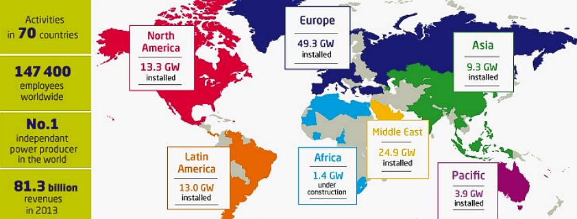
Suggested
from this map of the international operations of GDF Suez, it appears
that the Middle East consumes more power pro-rata than any other
developed region in the world.
ROADS
TRANSPORT IN EGYPT
Egypt has one of the highest incidence of road fatalities per miles driven in the world. There are few, if any road markings. Most traffic lights in Cairo
seem not to function, but rather intersections are staffed by policemen who use subtle finger movements to indicate which cars may move. Traffic rules are routinely ignored by impatient drivers: vehicles travel at high rates of speed or the wrong way on one-way streets. Pedestrians constantly dodge in and out of traffic, and animals are commonly on the roads.
Intercity roads are generally in good condition, but unmarked surfaces, stray animals, and disabled vehicles without lights or reflectors are among the many hazards that can be encountered on highways, especially after dark.
Rare winter rains can cause extremely slippery road surfaces or localized flooding.
Some roads, especially in the Sinai and southeastern part of the country, are off-limits to
foreigners.
Two routes in the Trans-African Highway network originate in Cairo. Egypt also has multiple highway links with Asia through the Arab Mashreq International Road Network. Egypt has a developing motorway network, connecting Cairo with Alexandria and other cities. Though most of the transport in the country is still done on the national highways, motorways are becoming increasingly an option in road transport within the country. The existing motorways in the country are:
* Cairo - Alexandria Deser Road: It runs between Cairo and Alexandria, with an extension of 215 km, it is the main motorway in Egypt.
* International Coastal Road: It runs from Alexandria to Port Said, along the Northern Nile Delta. It has a length of 280 km. Also, amongst other cities, it connects Damietta and
Baltim.
* Geish Road: It runs between Helwan and Asyut, along the Nile River, also connecting Beni Suef and Minya. Its length is 306 km.
* Ring Road: It serves as an inner ring-road for Cairo. It has a length of 103 km.
* Regional Ring Road: It serves as an outer ring road for Cairo, also connecting its suburbs like Helwan and 10th of Ramadan City. Its length is 130 km.
Egypt has developed an extensive system of 4-lane highways that can be classified as freeways because they serve as normal roads, thus rendering them slower than motorways.
There
is as yet no strategy to implement any transition from polluting IC
engines to clean electric vehicles, despite the abundance of free
solar energy from thousands of square miles of desert. This underused
resource could free the economy of the burden of expensive fossil fuel
purchases and significantly improve wealth generation and energy
independence. Tourism would also benefit from the transition to zero
pollution vehicles, as feature of holidays. Acid rain would be
reduced, helping to preserve the Pyramids
from erosion and the population would be healthier.
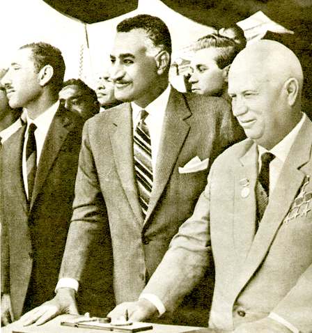
LEFT
- President Nasser and Nikita Khruschev watch the opening flood
sequence, which Khruschev described as the eighth wonder of the world. Gamal Abdel Nasser Hussein (15 January 1918 – 28 September 1970) was the second President of Egypt, serving from 1956 until
he died from a heart attack. He planned the 1952 overthrow of the monarchy, and was deputy prime minister in the new government. In 1953, Nasser introduced far-reaching land reforms.
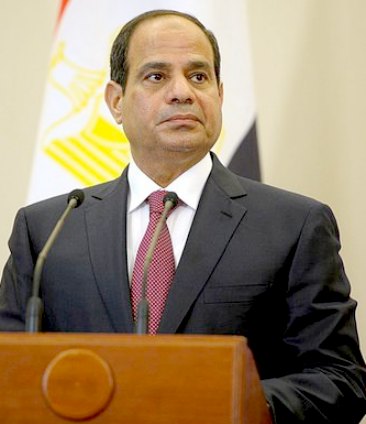
RIGHT
- Abdel Fattah Saeed Hussein Khalil el-Sisi (Arabic: عبد الفتاح سعيد حسين خليل السيسي ‘Abdu l-Fattāh Sa‘īd
Husayn Khalīl as-Sīsī, born 19 November 1954) is the sixth and current President of
Egypt. Born in Gamaleya, Old Cairo, Sisi graduated from Egyptian Military Academy and U.S. Army War College. Sisi got his bachelor of military Sciences in 1977, master from Egyptian Command and Staff College in 1987 and master of military sciences from Joint Services Command and Staff College, UK in 1992 in addition to U.S. Army War College fellowship.
On 26 March 2014, amid calls for Sisi to run for president, he resigned from the military announcing he would stand as a candidate in the 2014 presidential election. The poll, held between 26 and 28 May 2014 without the participation of most political parties, resulted in a resounding victory for el-Sisi over his sole opponent. Sisi was sworn into office as President of Egypt on 8 June 2014.
THE
ASWAN DAM
The Aswan Dam is an embankment dam situated across the Nile River in Aswan, Egypt. Since the 1960s, the name commonly refers to the High Dam. Construction of the High Dam became a key objective of the Egyptian Government following the Egyptian Revolution of 1952, as the ability to control floods, provide
water for irrigation, and generate hydroelectricity were seen as pivotal to Egypt's industrialization. The High Dam was constructed between 1960 and 1970, and has had a significant impact on the economy and culture of Egypt.
Before the dams were built, the Nile River flooded every year during late summer, when water flowed down the valley from its East African drainage basin. These floods brought high water and natural nutrients and minerals that annually enriched the fertile soil along the floodplain and delta; this had made the Nile valley ideal for farming since ancient times. Because floods vary, in high-water years the whole crop might be wiped out, while in low-water years widespread drought and famine occasionally occurred. As Egypt's population grew and conditions changed, both a desire and ability developed to control the floods, and thus both protect and support farmland and the economically important cotton crop. With the reservoir storage provided by the Aswan dams, the floods could be lessened and the water stored for later release.
The
EuroStation
concept will go further, firstly making energy from nature available
for transport, and then storing that electricity from solar and hydro
generated energy for later use as a means to overcoming peaks and
troughs in demand.
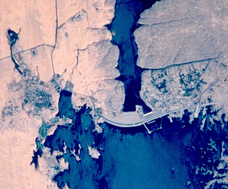
NASA
satellite picture of the Aswan Dam
DAM
STATISTICS
The Aswan High Dam is 3,830 metres (12,570 ft) long, 980 metres (3,220 ft) wide at the base, 40 metres (130 ft) wide at the crest and 111 metres (364 ft) tall. It contains 43,000,000 cubic metres (56,000,000 cu yd) of material. At maximum, 11,000 cubic metres per second (390,000 cu ft/s) of water can pass through the dam. There are further emergency spillways for an extra 5,000 cubic metres per second (180,000 cu ft/s) and the Toshka Canal links the reservoir to the Toshka Depression. The reservoir, named Lake Nasser, is 550 kilometres (340 mi) long and 35 kilometres (22 mi) at its widest with a surface area of 5,250 square kilometres (2,030 sq mi). It holds 132 cubic kilometres (1.73×10¹¹ cu yd) of water.
IRRIGATION
Due to the absence of appreciable rainfall, Egypt's agriculture depends entirely on irrigation. With irrigation, two crops per year can be produced, except for sugar cane which has a growing period of almost one year.
The high dam at Aswan releases, on average, 55 cubic kilometres (13 cu mi) water per year, of which some 46 cubic
kilometres (11 cu mi) are diverted into the irrigation canals.
In the Nile valley and delta, almost 33,600 square kilometres (13,000 sq mi) benefit from these waters producing on average 1.8 crops per year. The annual crop consumptive use of water is about 38 cubic kilometres (9.1 cu mi). Hence, the overall irrigation efficiency is 38/46 = 0.82 or 82%. This is a relatively high irrigation efficiency. The field irrigation efficiencies are much less, but the losses are re-used downstream. This continuous re-use accounts for the high overall efficiency.
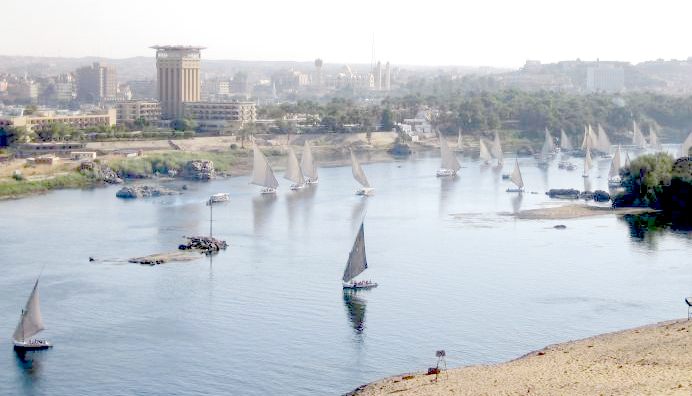
A
view from Aswan to Al-Hawa across the River Nile
ASWAN ECONOMIC BENEFITS
The High Dam has resulted in protection from floods and droughts, an increase in agricultural production and employment, electricity production and improved navigation that benefits tourism. Conversely, the dam flooded a large area, causing the relocation of over 100,000 people and submerged archaeological sites, some of which were relocated as well. The dam is also blamed for coastline erosion, soil salinity and health problems.
The assessment of the costs and benefits of the dam remains a controversial issue, however, decades after its completion. According to one estimate, the annual economic benefits of the High Dam right after its completion were Egyptian Pound (EP) 255 million
(US$587 million using the 1970 exchange rate of US$2.30 per EP): EP140 million from agricultural production, EP100 million from hydroelectric generation, EP10 million from flood protection, and EP5 million from improved navigation. At the time of its construction, total cost, including unspecified "subsidiary projects" and the extension of electric power lines, amounted to Egyptian EP450
million. Not taking into account the negative environmental and social impacts of the dam, its costs are thus estimated to have been recovered within only two years
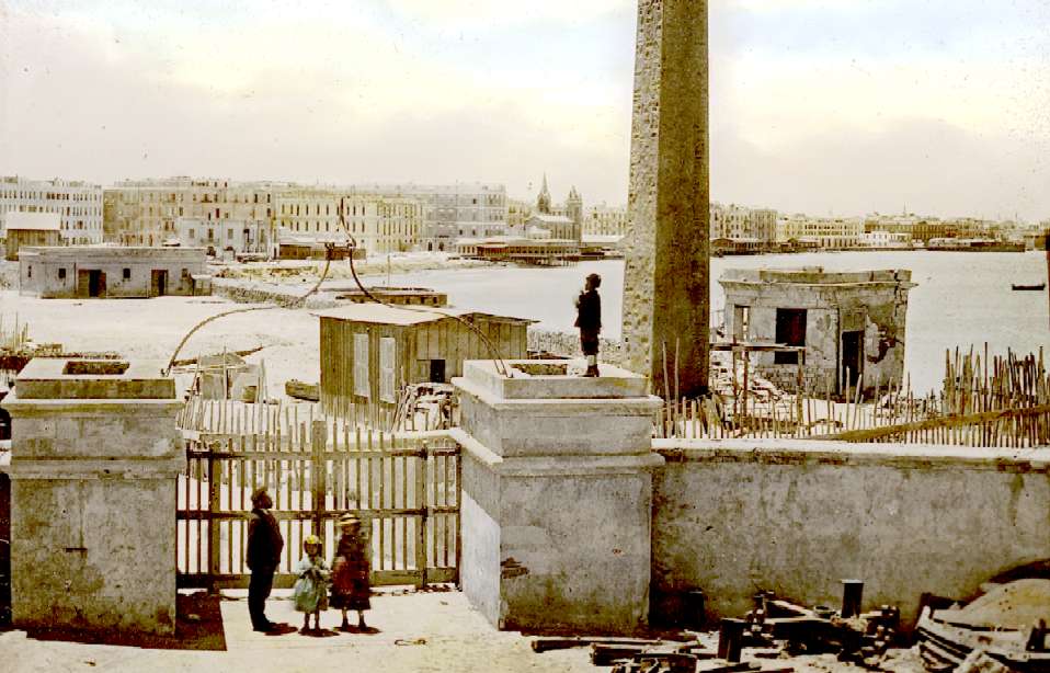
The
port of Alexandria is named after Alexander the Great. This is an
archive picture showing the pillar obelisk in the foreground.
ALEXANDRIA
Alexandria is the second largest city and the second largest metropolitan area in Egypt after Greater Cairo by size and population, extending about 32 km (20 mi) along the coast of the Mediterranean Sea in the north central part of the country. It is also the largest city lying directly on the Mediterranean coast. Alexandria is Egypt's largest seaport, serving approximately 80% of Egypt's imports and exports. It is an important industrial center because of its natural gas and oil pipelines from Suez. Alexandria is also an important tourist resort.
Alexandria was founded around a small Ancient Egyptian town c. 331 BC by Alexander the Great. It became an important center of the Hellenistic civilization and remained the capital of Hellenistic and Roman & Byzantine Egypt for almost 1000 years until the Muslim conquest of Egypt in AD 641, when a new capital was founded at Fustat (later absorbed into Cairo). Hellenistic Alexandria was best known for the Lighthouse of Alexandria (Pharos), one of the Seven Wonders of the Ancient World; its Great Library (the largest in the ancient world; now replaced by a modern one); and the Necropolis, one of the Seven Wonders of the Middle Ages.
ALEXANDRIA'S CLIMATE
Alexandria has a hot desert climate (Köppen climate classification: BWh), but as the rest of Egypt's northern coast, the prevailing north wind, blowing across the
Mediterranean, gives the city a less severe climate from the desert hinterland. Rafah and Alexandria are the wettest places in Egypt, the other wettest places are Rosetta, Baltim, Kafr el-Dawwar and Mersa Matruh. The city's climate is influenced by the Mediterranean Sea, moderating its temperatures, causing variable rainy winters and moderately hot summers that, at times, can be very humid; January and February are the coolest months, with daily maximum temperatures typically ranging from 12 to 18 °C (54 to 64 °F) and minimum temperatures that could reach 5 °C (41 °F). Alexandria experiences violent
storms, rain and sometimes sleet and hail during the cooler months. July and August are the hottest and driest months of the year, with an average daily maximum temperature of 30 °C (86 °F). The average annual rainfall is around 200 mm (7.9 in) but has been as high as 417 mm (16.4 in).
ANCIENT REMAINS
Due to the constant presence of war in Alexandria in ancient times, very little of the ancient city has survived into the present day. Much of the royal and civic quarters sank beneath the harbor due to
earthquake subsidence in AD 365, and the rest has been built over in modern times.
"Pompey's Pillar", a Roman triumphal column, is one of the best-known ancient monuments still standing in Alexandria today. It is located on Alexandria's ancient acropolis—a modest hill located adjacent to the city's Arab cemetery—and was originally part of a temple colonnade. Including its pedestal, it is 30 m (99 ft) high; the shaft is of polished red granite, 2.7 meters in diameter at the base, tapering to 2.4 meters at the top. The shaft is 88 feet (27 m) high made out of a single piece of granite. This would be 132 cubic meters (4,662 cubic feet) or approximately 396 tons. Pompey's Pillar may have been erected using the same methods that were used to erect the ancient obelisks. The
Romans had cranes but they were not strong enough to lift something this heavy.
The most extensive ancient excavation currently being conducted in Alexandria is known as Kom al-Dikka. It has revealed the ancient city's well-preserved theater, and the remains of its Roman-era baths.
The Temple of Taposiris Magna was built in the Ptolemy era and dedicated to Osiris, which finished the construction of Alexandria. It is located in Abusir, the western suburb of Alexandria in Borg el Arab city. Only the outer wall and the pylons remain from the temple.
LINKS
& REFERENCE:
http://en.wikipedia.org/wiki/Alexandria
Wikipedia
Ice_Cold_in_Alex
http://en.wikipedia.org/wiki/Ice_Cold_in_Alex
Map
Quest
Map
search gis asset renewable energy data
Map
search gis asset electric power data
Map
search
Maps
Yahoo
Microsoft
Maps
Wikipedia
Dubai
Wikipedia
Mecca
Wikipedia
Jeddah
Wikipedia
United_Arab_Emirates
Wikipedia
Saudi_Arabia
Michelin
Challenge Bibendum
http://en.wikipedia.org/wiki/Dubai
http://en.wikipedia.org/wiki/Mecca
http://en.wikipedia.org/wiki/Jeddah
http://en.wikipedia.org/wiki/United_Arab_Emirates
http://en.wikipedia.org/wiki/Saudi_Arabia
http://evworld.com/news.cfm?newsid=29419
http://www.challengebibendum.com/
http://www.challengebibendum.com/eng/Our-approach/our-mission
http://stateofgreen.com/en
http://irena.org/
http://www.ebrd.com/
http://www.ducc.co.uk
http://www.forbes.com
2014 oil-majors-woes-good-news-for-tesla-and-other-ev-makers
http://metro.co.uk
2011 cannonball run remake attracts bids from rival guy ritchie and
shawn levy
http://en.wikipedia.org/wiki/The_Cannonball_Run
mile-to-km.com/km-to-miles
New
York Times
2014/11/11 Denmark-aims-for-100-percent-renewable-energy
http://www.mile-to-km.com/km-to-miles.php
http://www.worldsolarchallenge.org/
http://www.mapquest.com/
http://www.mapsearch.com/gis-asset-data/renewable-energy-gis-data.html
http://www.mapsearch.com/gis-asset-data/electric-power-gis-data.html
http://www.mapsearch.com/index.html
https://uk.maps.yahoo.com/
http://www.microsoft.com/maps/
https://maps.google.com/
http://www.rideacrossbritain.com/packages/end-to-end/
The
Cannonball
Run - Fictional series above is for historic vehicles. Ones that are over forty
years old.