|
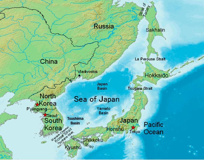
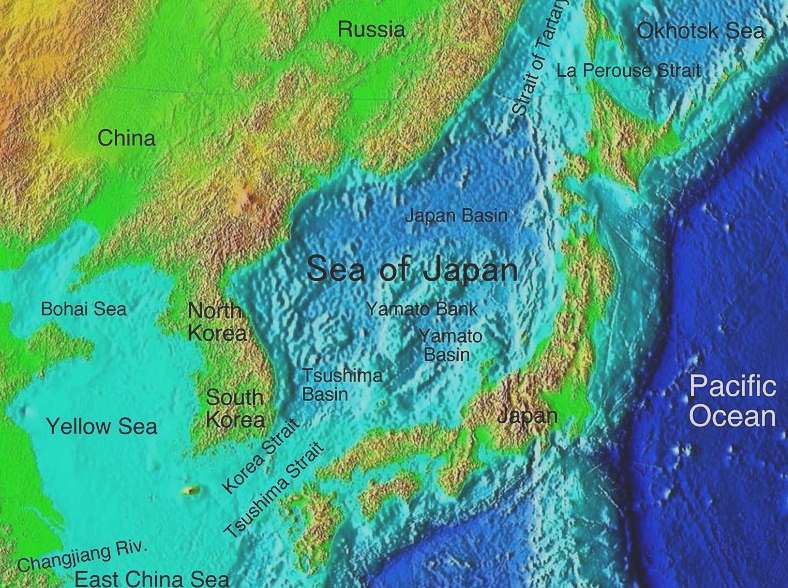
Map
of the Sea of Japan, also known as the East Sea, not yet a sea of
tranquility
Regarding the name dispute, that we understand remains unresolved. We hope
Korea (N&S) and Japan might reach some kind of agreement sometime in the future – even if only
an agreement to disagree. Every nation should respect the viewpoint of other nations. Even in disagreement.
That is a United Nations objective and a right under the Universal
Declaration.
We are non-political, but support the right of everyone to freedom of speech, thought and opinion.
Because these rights are (or should be) universal. Our battle is against ocean pollution and
climate change.
We are all guilty of adding to that, or not doing enough to prevent it.
KOREA HERALD 25 APRIL 2017
GENEVA - South Korea and Japan were divided over the usage of "East Sea" in naming the body of water between the Korean Peninsula and Japan as a conference of the International Hydrographic Organization opened in Monaco on Monday, South Korean officials said.
Koreans claim that East Sea has been used for more than 2,000 years. But the name was not known internationally in modern times because the Korean Peninsula was under Japan's colonial rule from 1910-45.
At the IHO's 19th general assembly, a South Korean delegation consisting of 30 government officials and private-sector experts plan to have the organization's publication "Limits of Oceans and Seas" revised to include the East Sea.
The publication, also known as S-23, is designed to serve as guidelines on the limits and names of oceans and seas for the benefit of national hydrographic offices in compiling nautical charts. It at present refers to the waters between the two countries only as the Sea of Japan.
S-23 was last revised in 1953, but discord over how to name the sea between the two neighbors has hampered the revision efforts.
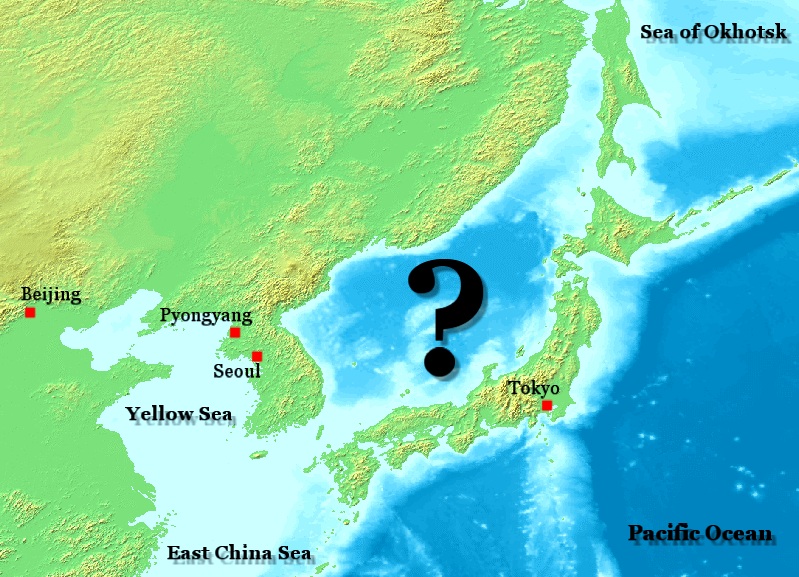
The
sea with many names? Also known as Tokai/Japan Sea. The name Tokai first appeared in South Korea's History of the Three Kingdoms and the King of the Tomei King (37 BC). Tokai has long been regarded as a place of life by Korean people and historians.
According to one interested person/group, the name "Tokai" was destroyed when Korea was occupied under Japanese colonial rule. The suggestion is that the name "Tokai" could replace the name "Sea of Japan."
MEDIA
A number of maps, encyclopedias, and other publications have switched to using both names. For example, the Manual of Style of the National Geographic Society states that disputed place-names in international waters or jointly controlled by two or more countries should use the conventional name first with other names following in parentheses. As such, their policy on this sea states that "The internationally accepted name is Sea of Japan, although Korea prefers East Sea. When scale permits, Geographic maps show the alternative name East Sea in parentheses after Sea of Japan."
In 2006, Google put both names on Google Earth, using East Sea near the Korean coast and Sea of Japan near the Japanese
coast. In the 2007 edition of Encyclopædia Britannica, the primary article is called "Sea of Japan". A secondary article called "East Sea" notes "see Japan, Sea of". On the encyclopedia's map of Japan and other Asia maps, Sea of Japan appears as the primary label and East Sea appears as a secondary label in parentheses. However, on the map of Korea the name East Sea appears as the primary label and Sea of Japan appears as a secondary label in parentheses. Other examples of publishers who use similar systems include Microsoft Encarta, the Columbia Electronic Encyclopedia, and About.com.
In 2012, French encyclopedia publisher Larousse replaced "Mer du Japon" ("Sea of Japan") with "Mer de L'est (Mer du Japon)" ("East Sea (Sea of Japan)") in maps of South Korea and North Korea in two of its books. However, other maps, such as those of Asia, China, Japan, and Russia, continue to use "Mer du Japon". Furthermore, the article "Mer du Japon" does not mention "East Sea" at all.
In 2013, Bandai Namco Games, a Japanese game developer, initially presented both names as "Sea of Japan (East Sea)" in Ace Combat Infinity. There was intense backlash from the Japanese community for including the Korean name at all. In response, the company removed all international borders and labels from the game's maps and heavily blurred them to maintain neutrality.
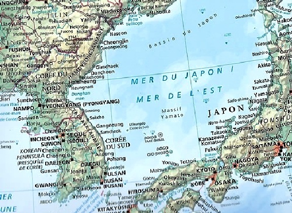
Map
showing both names to allow students from each country to appreciate the
location.
COMMON
SENSE
We
can see no reason why each of the parties to this dispute might not use
the name they prefer, with polite reference to the name of the other party
- if they so choose. If you are looking from North or South Korea, then
the sea is east. Looking from Japan it would be North or West - again,
depending on which part of the country you are located.
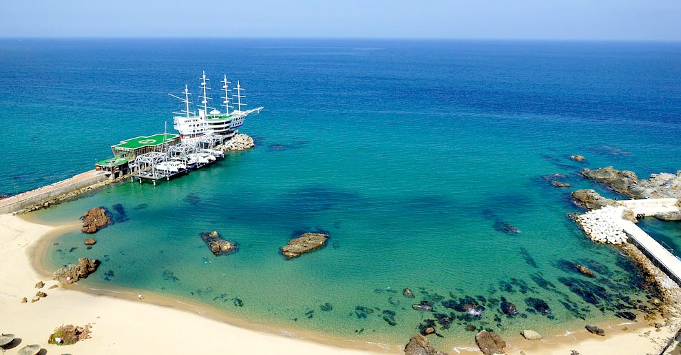
Attraction
at Gangneung East Sea
INTERNATIONAL HYDROGRAPHY ORGANIZATION
The International Hydrographic Organization is an organization that coordinates with member countries over hydrographic issues. One of the organization's functions is to standardise the delineation of nautical regions. In 1929, the organization (then called the International Hydrographic Bureau) published edition 1 of "IHO Special Publication 23" (IHO SP 23) – Limits of Oceans and Seas, which included the limits of the sea area between the Korean peninsula and Japan and the name Sea of Japan; however, at that time, Korea could not participate in the IHO because it was under Japanese rule. The name Sea of Japan remains in the current edition 3 of S-23, that was published in
1953. South Korea officially joined the IHO in 1957.
In 1974, IHO released Technical Resolution A.4.2.6. This resolution stated that:
It is recommended that where two or more countries share a given geographical feature (such as a bay, a strait, channel or archipelago) under different names, they should endeavour to reach agreement on a single name for the feature concerned. If they have different official languages and cannot agree on a common name form, it is recommended that the name forms of each of the languages in question should be accepted for charts and publications unless technical reasons prevent this practice on small scale charts.
South Korea has argued that this resolution is relevant to the debate about the Sea of Japan and implies that both names should be used; Japan, however, argues that the resolution does not apply to the Sea of Japan, because it does not specify this body of water and only applies to geographical features for which sovereignty is shared between two or more countries.
The IHO agreed to conduct a survey of available evidence in 2011. Previously, South Korea had been pushing the IHO to recommend only using the term East Sea, but announced on 2 May 2011, that it now preferred the gradual approach of using both names now, and eventually dropping the Sea of Japan name.
On 26 April 2012, after several different attempts over several years to revise the 1953 edition of S-23 – Limits of Oceans and Seas, the IHO Member States decided that it was not possible to make progress with a revision. As a result, only "Sea of Japan" continues to appear in S-23. An IHO consulting group is meant to report on the issue in 2020. In September 2020, the IHO announced that it would adopt a new numerical system like any other sea, also known as "S-130". In November 2020, the IHO rejected South Korea’s demand and continued the use of the Sea of Japan name alone in official nautical charts.
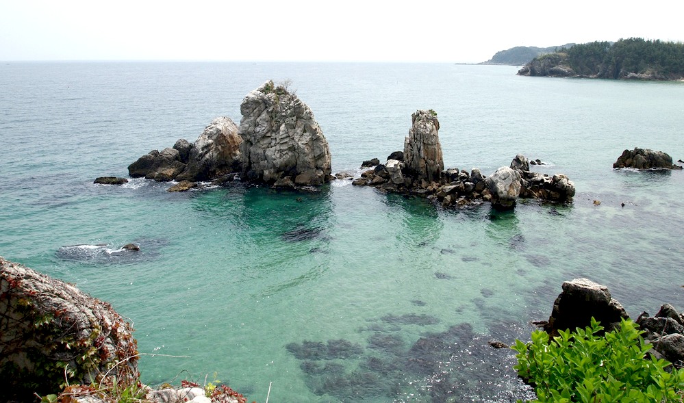
Coastline
of Korea, East Sea or Sea of Japan, depending on your viewpoint
DEBATE CONTINUES
A dispute exists over the international name for the body of water which is bordered by Japan, Korea (North and South) and Russia. In 1992, objections to the name Sea of Japan were first raised by North Korea and South Korea at the Sixth United Nations Conference on the Standardization of Geographical Names. The Japanese government supports the exclusive use of the name "Sea of Japan" (日本海), while South Korea supports the alternative name "East Sea" (Korean:
동해; Hanja:
東海), and North Korea supports the name "Korean East Sea" (Korean:
조선동해; Hanja:
朝鮮東海). Currently, most international maps and documents use either the name Sea of Japan (or equivalent translation) by itself, or include both the name Sea of Japan and East Sea, often with East Sea listed in parentheses or otherwise marked as a secondary name. The International Hydrographic Organization, the governing body for the naming of bodies of water around the world, in 2012 decided it was still unable to revise the 1953 version of its publication S-23 – Limits of Oceans and Seas, which includes only the single name "Sea of Japan", to include "East Sea" together with "Sea of Japan".
The involved countries (especially Japan and South Korea) have advanced a variety of arguments to support their preferred name(s). Many of the arguments revolve around determining when the name Sea of Japan became the common name. South Korea argues that historically the more common name was East Sea, Sea of Korea, or another similar variant. South Korea further argues that the name Sea of Japan did not become common until Korea was under Japanese rule, at which time it had no ability to influence international affairs. Japan argues that the name Sea of Japan has been the most common international name since at least the beginning of the 19th century, long before its annexation of Korea. Both sides have conducted studies of antiquarian maps, but the two countries have produced divergent research results. Additional arguments have been raised regarding the underlying geography of the sea as well as potential problems regarding the ambiguity of one name or the other.
Regardless
of what name you think might (should) be applied, what is common to all
nations sharing a coastline with the sea in question, is cooperation when
it come to controlling toxic plastic and other marine pollution and blue
growth. Otherwise, the sea could end up being branded the 'Plastic
Sea.' Or if pollution worsens, the 'Toxic
Sea' or 'Cancerous
Sea.'
UN FAO ON BLUE GROWTH
What is blue growth?
The concept of a "blue economy" came out of the 2012 Rio+20 Conference and emphasizes conservation and sustainable management, based on the premise that healthy ocean ecosystems are more productive and a must for sustainable ocean-based economies.
To support a shift to this new approach, FAO launched the Blue Growth Initiative, through which it will assist countries in developing and implementing blue economy and growth agendas.
Why blue growth?
Blue growth looks to further harness the potential of oceans, seas and coasts to:
* Eliminate harmful fishing practices and overfishing and instead incentivize approaches which promote growth, improve conservation, build sustainable fisheries and end illegal, unreported and unregulated fishing
*
Ensure tailor-made measures that foster cooperation between countries
*
Act as a catalyst for policy development, investment and innovation in support of food security, poverty reduction, and the sustainable management of aquatic resources.
How will it be implemented?
* Aquaculture – promote policies and good practices for farming of
fish, shellfish and marine plants in a responsible and sustainable manner
*
Capture fisheries – support implementation of the Code of Conduct for Responsible Fisheries (CCRF) and related instruments to restore fish stocks, combat IUU and promote good fish production practices and growth in a sustainable manner
*
Seafood systems – promote efficient seafood value chains and improved livelihoods
* Eco-system services – Promote regulatory regimes and approaches to restore vital coastal habitats,
biodiversity and eco-system services (incl. carbon capture, storm and wave defenses,
tourism etc).
BLUE
GROWTH = SUSTAINABLE MARINE
DEVELOPMENT
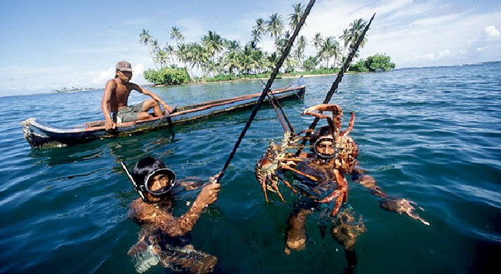
Japan is an island nation with a population of 128 million, a land area of 377 801 km², a coastline of 29 751 km, and an EEZ of approximately 4.05 million km², the sixth largest in the world and about twelve times larger than the national land area. A combination of warm and cold currents flows along the coasts, creating one of the most abundant fishing grounds in the world.
Due to such geographical features, fisheries traditionally play an important role in food security in Japan, providing a variety of
fish and fishery products which account for 61.2 kg per capita annual intake of the Japanese nation in 2005. The total fishery production of Japan was 5 million tonnes (excluding seaweed) in 2007, out of which 766 000 tonnes were derived from aquaculture. Japan was the fifth largest capture fishery producer in the world in 2007.
For statistical convenience, Japanese marine fisheries are divided into three categories: distant-water fisheries (operated mainly on the high seas, as well as under bilateral agreements in the EEZs of foreign countries); offshore fisheries (operated mainly in the domestic EEZ, as well as under bilateral agreements in the EEZs of neighbouring countries); and coastal fisheries (operated mainly in waters adjacent to fishing villages).
Of the three categories, distant-water fisheries and offshore fisheries have been declining: the former yielded 518 000 t (worth JPY 153 900 million or about USD 1 620 million1), and the latter yielded 2 500 000 t (worth JPY 399 600 million or about USD 4 206 million) in 2006. In contrast, coastal fisheries have maintained a stable supply of marine products, yielding 1 451 000 t (worth JPY 524 800 million or about USD 5 524 million) in 2006.
In terms of the number of workers, coastal fisheries dominate, with about 212 470 people involved, or 89% of the total (239 810) in 2006. In 2007, the total number of fishers was 204 330, continuing to decline as a consequence of the acceleration of the ageing of fishers. The total number of powered fishing vessels registered was 232 534 (2005).
Mariculture
Mariculture plays an important role in seafood supply, producing 1 237 000 t in 2007 (worth about USD 3 836 million). The main products from mariculture are seaweeds (42%, mostly destined for human consumption), Yesso scallops (20%), oysters (16%), Japanese amberjack (13%) and silver seabream (5%). Production has been broadly flat for the last 10 years, after reaching a peak in 1994. This is due to the limited capacity of farms, the decreasing fish price and the excessive supply of cultured fish.
(1) Exchange rate applied: 1 USD = 95 JPYManagement applied to main fisheriesThe management of fisheries in Japan has been implemented by the fisheries right system for coastal fisheries and the fisheries licensing system for offshore and distant-water fisheries, based on the Fisheries Law. Both systems are input control (fishing efforts), such as control of the number of fishers or fishing vessels and regulation of fishing gear, areas and seasons.
Following the ratification of the United Nations Convention on the Law of the Sea (UNCLOS) in 1996, Japan introduced the Total Allowable Catch (TAC) system in 1997 as output (catch) control according to the Law Concerning Conservation and Management of Living Marine Resources. Currently, seven species, namely saury, Alaska pollack, sardine, jack mackerel, common and spotted mackerel, common squid and snow crab, are subject to the TAC system.
Japan also introduced the Total Allowable Effort (TAE) system, which further reinforces the input control by regulating the total level of fishing effort such as total days of fishing operations. The combination of the input and output control is expected to pr omote sustainable fisheries. Regarding offshore waters, representatives of the various types of fisheries involved are now required to form “Regional Fisheries Coordination Committees” that will elaborate, in consultation with the national and prefectural governments, the Resources Recovery Plans in which various kinds of conservation and management measures including TAC and TAE will be implemented in a coordinated manner. In coastal waters, “Resources Management-Type Fisheries” are promoted by a co-management system between coastal fishers and prefecture governments.
Fisheries cooperatives play a vital and essential role in this process for securing responsible and sustainable fisheries. To prevent, deter and eliminate IUU fishing and uncontrolled importation of their catch, the “Law of Special Measures for Strengthening Conservation and Management of Tuna Resources” was established in 1996 and has been controlling trade of tunas caught by IUU and reflagged fishing vessels. Furthermore, the Organization for the Promotion of Responsible
Tuna Fisheries (OPRT) was established in 2000 as an initiative taken by the tuna industries to combat IUU
fishing.
Inland
sub-sector Japanese rivers and lakes are so narrow that the scale of inland water fishing resources is quite limited. Nevertheless, inland waters play an important role in providing various freshwater fish and shellfish, such as ayu sweetfish, Plecoglossus altivelis, providing not only opportunities for commercial fisheries but also for recreational fishing, to commune with nature, and preserve the natural environment. Production of inland fisheries and inland aquaculture was 81 000 t in 2007 (39 000 t and 42 000 t respectively). The main products from inland fisheries are Salmonoids (42%), corbicula clam (28%) and ayu sweetfish (8%), while the main species for inland aquaculture are eels (54%), trout (26%), ayu sweetfish (14%) and common carp (6%).
However, inland waters are currently suffering fishery- and ecosystem-related damage due to predation of indigenous fish species by black bass and other alien species. Under such circumstances, the Invasive Alien Species Act was established for the purpose of regulating the raising, carrying or importing of designated invasive alien species and to eliminate such species. Currently, 13 Species of fish and four species of invertebrate are listed as specified alien
species.
(see also
http://www.fao.org/fishery/countrysector/naso_japan/en)
Aquaculture sub-sectorSee para 3.3.
More information at: National
Aquaculture Sector Overview (NASO)
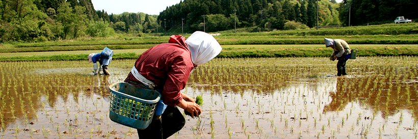
AGRICULTURE -
Rice is the life-blood of the Asia-Pacific Region where 56 percent of humanity lives, producing and consuming more than 90 percent of the world’s rice. The demand for
rice is expected to grow faster than the production in most countries. How the current level of annual production of 524 million tonnes could be increased to 700 million tonnes by the year 2025 using less land, less water, less manpower and fewer agro-chemicals is a big question. Alternative ways to meet the challenge by horizontal and vertical growth have their own prospects and limitations.
Rice is the staple food of Asia and part of the Pacific. Over 90 percent of the world’s rice is produced and consumed in the Asia-Pacific Region. With growing prosperity and urbanization, per capita rice consumption has started declining in the middle and high-income Asian countries like the Republic of Korea and Japan. But, nearly a fourth of the Asian population is still poor and has considerable unmet demand for rice. It is in these countries that rice consumption will grow faster. The Asian population is growing at 1.8 percent per year at present, and population may not stabilize before the middle of the next century. A population projection made for the year 2025 shows an average increase of 51 percent, and in certain cases up to 87 percent over the base year 1995. So far the annual growth rate for rice consumption in the Asia-Pacific Region over a period of 45 years (1950 to 1995) has kept pace with the demand, though as world population increases from 7 billion to the projected 9 billion souls in coming years the present yield increases are unlikley to be sustainable.
Post-harvest sector
Fish utilizationIn 2006, 86% or 4 360 000 t of the Japanese domestic fishery production was destined to human consumption, while the rest, 710 000 t, was destined for industrial use, including fishmeal to meet the demand for feeds for livestock and aquaculture purposes. 16% or 790 000 t of the domestic fishery production was exported. 65% or 3 710 000 t of annual Japanese imports of fish and fishery products was used for human consumption. In total, domestic supply of fish and fishery products in Japan was 9 820 000 t and 75% or 7 358 000 t was destined to human consumption. Domestic production supported about 59 percent of national consumption of fish and fishery products in 2006. Among those for human domestic consumption, 40 percent or 2 946 000 t are fresh or frozen products, 55 percent or 4 078 000 t are salted, dried, smoked, etc, and 5 percent or 334 000 t are canned
products.
Fish marketsBased on traditional fish-eating culture, in particular with appreciation for absolutely fresh raw fish, Japan established a unique marketing and distribution system of fish and fishery products with a network of fish markets in landing sites and those in consumption centers. However, many of local fish markets are in economic difficulties due to reduced turnover as catches have declined in both volume and value and merging and reinforcement of those markets is
underway.
The Wholesale Market Law was revised in June 2004 to promote a safer, more reliable and effective distribution system that meets consumer needs while reflecting relevant socio-economic changes. In relation to quality control of fish and fishery products, with the aim of meeting consumers’ higher awareness of freshness and safety of food, the Japanese Agricultural Standard (JAS) Law was revised in 1999 to require appropriate labelling of all food products. The labelling of fish and fishery products has to include description of fishing area for fresh fish and materials used for the processed fishery products. The first accreditation to a Japanese fisheries importer by the Marine Stewardship Council (MSC), an International NGO, was reported in 2006. A new certification scheme, “Marine Eco-Label Japan (MEL-Japan)” was established on 6 December 2007 mainly by Japan Fisheries Association (JFA) in collaboration with the national Government, other relevant organizations and an academic society based on the FAO Guidelines for the Ecolabelling of Fish and Fishery Products from Marine Capture Fisheries. Generally FAO’s technical guidance and guidelines on ecolabelling are expected to facilitate an appropriate implementation of the ecolabelling system in the Japanese fisheries.
Socio-economic contribution of the fishery sector
- Role of fisheries in the national economy
Fisheries play an important role in food security in Japan and, being a primary industry in coastal areas, contribute significantly to regional economies. Being distributed countrywide, fishing communities make a vital contribution to the preservation of local traditional culture in the form of fish-eating habits, festivals, customs and
manners.
As Japan is a country with limited agronomic and livestock-raising potential, marine products are an indispensable source of food for the large population, and in 2005 provided about 61.2 kg of fish on a crude food weight basis and to 34.6 kg on a net weight basis for direct
human consumption per year per capita. Furthermore, this sector supports (2006) some 212 470 fishers, although the number of fishers is continuously decreasing and their average age continues rising.
Fishing villages need revitalization to become more attractive to the young generation in order to secure an appropriate level of recruitment of new fishers and thus keep fishery industries and communities active and vital. Women fishery workers numbered 33 000 in 2007 or 16 percent of the total number of fishers, who are mainly engaged in coastal fisheries. At the end of 2006, Japan had 2 273 fisheries cooperative associations, including 1 267 for coastal regions, 864 for inland waters and 142 sector-specific
associations.
Trade
In 2007, Japan was the second major importer of fishery commodities following China with USD 13.2 billion, 5.6 percent less than 2006 in value, while exports experienced a 17.9 percent growth to USD 1.7 billion. China has been the largest fishery product exporter to Japan since 1998, but imports from China in 2007 decreased by 13.2 percent in value terms from the previous year and reached JPY 318 billion (USD 3 billion). The main imported products are shrimp, tuna, salmon, crab, processed eel, cod’s roe, squid, etc.While importation has been declining, exportation of fish and fishery products from Japan has been increasing due to the popularity of Japanese dishes in the world and economic growth in Asia. The main exporting commodities in value are
pearl, salmon, mackerel, dried sea cucumber, Alaskan Pollock, scallop, etc.
Trends, issues and development
Development prospects in the near future are not bright in Japan. According to the results of a resource assessment on major fishery resources in the waters surrounding Japan, the levels of
fishery resources are low for almost half of the species or stocks assessed. In addition, the decrease in the number of fishers and their increasing average age pose serious problems, affecting the production structure and closely linked to the sustainable use of fishery resources and the stable supply of fish.
On the other hand, however, due to the growing demand for fish and fishery products in the world, the exportation of those products from Japan is increasing. The multi-faced functions, other than just food security, of fisheries and fishing communities, such as conservation of natural environment, national security and promotion and succession of the traditional culture, are also highly recognized and appreciated.
Much effort and measures are being taken to recover and enhance fisheries resources such as the establishment of resource recovery plans as well as to vitalize fishing
communities.
Research, education and
training
ResearchIn 2001, the National Research Institute of Fisheries Science became the Fisheries Research Agency (FRA) independent from the national Government and reinforced for comprehensive scientific research on fisheries. Stock enhancement and protection/ restoration of the aquatic environment are also promoted, mainly by the Japan
Sea-Farming Association (JASFA) and prefectural sea-farming centers, by releasing billions of seedlings and the preservation of nursery areas such as sea grass or seaweed beds. In 2003, the FRA expanded also to take over the duties of JASFA and the Japan Marine Resource Research Center (JAMARC) for further enhanced and comprehensive research and stock enhancement activities.
Among various kinds of research activities conducted by those institutes, the following areas of technology are particularly highlighted:
* Energy saving
* Satellite vessel monitoring
* Enhancement of efficiency and profitability of fisheries
* Improvement of fishing grounds and nursery areas of aquatic living resources
* Promotion of stock enhancement and aquaculture including those of bluefin tunas
* Development and promotion of bioenergy.
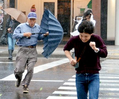
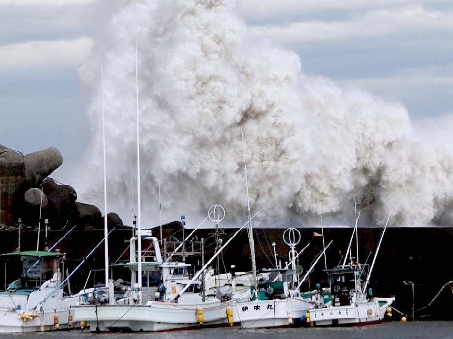
TYPHOON
PHANFONE - 5 OCTOBER 2014
While
not strictly a matter to do with the Sea of Japan, a powerful typhoon lashed
the coast of southern Japan on Sunday, churning up high waves that washed three
American
airmen out to sea and killed at least one.
In Suzuka, in central Japan, a French formula one driver was severely injured in an accident in the Japanese grand prix, which had to be shortened because the heavy rain made conditions too dangerous.
One of the three US airmen was found dead. The other two were missing, according to the air force and the Japanese coast guard. They had been on Okinawa island’s northern coast when they were overcome by the waves, according to Tsuguyoshi Miyagi of the coast guard’s Okinawa branch.
The air force said the search for the missing airmen had been interrupted by rough seas. Their names were being withheld pending notification of relatives.
Okinawa is home to about half of the 50,000 American troops stationed in Japan.
In Suzuka, the Formula One driver Jules Bianchi of the Marussia team went off the track at a turn and hit a recovery vehicle that was removing a car that had crashed earlier. An unconscious Bianchi was taken to a nearby hospital, where he underwent emergency surgery for a severe head injury. Race officials said he was in critical condition.
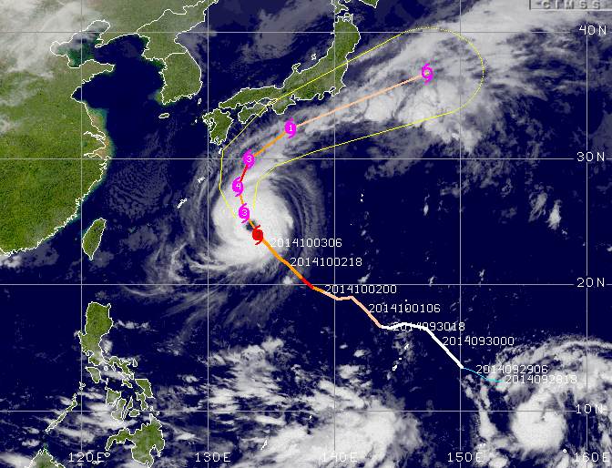
Track
of Typhoon Phanfone - Pacific Ocean tropical revolving storms
By late Sunday, Typhoon Phanfone was off the coast of Shikoku in south-western Japan, with winds of up to 90mph after hitting the regions of Okinawa and Kyushu, Japan’s Meteorological Agency said.
Several people on Kyushu island were injured in the typhoon. The storm also grounded more than 100 flights on Sunday and knocked out power to more than 9,500 Kyushu homes.
The storm triggered concern about possible landslides on the ash-covered
volcano in central Japan that erupted on 27 September and killed at least 51 hikers. The search for a dozen
people missing in the eruption was suspended on Sunday because of rain from the approaching storm.
The meteorological agency predicted up to 40cm (16in) of rain for central Japan by Monday morning.
Elsewhere in the Pacific, a separate typhoon whipped the Mariana Islands, including Guam, with high winds and
heavy
rain.
The eye of the typhoon in the Marianas was expected to pass over the small island of Rota, which has about 2,500 residents and many buildings made of
concrete.
Typhoon Vongfong had maximum sustained winds estimated at 105mph, said Roger Edson of the National Weather Service in Guam. Winds on the islands of Guam, Tinian and Saipan were gusting to at least 55mph, he said.
Residents on Guam heeded warnings about high winds and possible flooding by taking shelter at designated public
schools. The island government and many businesses were expected to be closed on Monday, and most flights were cancelled.
GENERAL
The Sea of
Japan is a marginal sea of the western Pacific Ocean, between the Asian mainland, the Japanese archipelago and Sakhalin. It is bordered by
Japan, North Korea, Russia and South Korea. Like the Mediterranean Sea, it has almost no tides due to its nearly complete enclosure from the Pacific Ocean. This isolation also reflects in the fauna species and in the water salinity, which is lower than in the ocean. The sea has no large islands, bays or capes. Its water balance is mostly determined by the inflow and outflow through the straits connecting it to the neighboring seas and Pacific Ocean. Few rivers discharge into the sea and their total contribution to the water exchange is within 1%.
The seawater is characterized by the elevated concentration of dissolved oxygen that results in high biological productivity. Therefore, fishing is the dominant economic activity in the region. The intensity of shipments across the sea has been moderate owing to political issues, but it is steadily increasing as a result of the growth of East Asian economies. A controversy exists about the sea name, with South Korea promoting the appellation East Sea (Korean:
동해 Donghae)
HISTORY
The Sea of Japan was once a landlocked sea when the land bridge of East Asia existed. The onset of formation of the
Japan Arc was in Early
Miocene. The Early Miocene period also corresponds to incipient opening of the Japan Sea, and the northern and southern parts of the Japanese archipelago that were separated from each other. During the Miocene, there was expansion of Sea of Japan. The northern part of the Japanese archipelago was further fragmented at later periods until the orogenesis of the northeastern Japanese archipelago began in the later Late Miocene. The southern part of the Japanese archipelago remained as a relatively large landmass. The land area had expanded northward in the Late Miocene. The orogenesis of high mountain ranges in the northeastern Japan started in Late Miocene and it lasts in Pliocene also.
For centuries, the sea had protected Japan from land invasions, particularly by the Mongols. It had long been navigated by Asian and, from the 18th century, by
European ships. Russian expeditions of 1733–1743 mapped Sakhalin and the Japanese islands. In the 1780s, the Frenchman Jean-François de Galaup, comte de Lapérouse, traveled northward across the sea through the strait that was named after him. In 1796, another
Frenchman Robert Broughton explored the Strait of Tartary, the eastern coast of the Russian Far East and the Korean Peninsula. In 1803–1806, the Russian navigator Adam Johann von Krusenstern while sailing across the globe in the ship Nadezhda also explored, in passing, the Sea of Japan and the eastern shores of Japanese islands. In 1849, another
Russian explorer Gennady Nevelskoy discovered the strait between the continent and Sakhalin and mapped the northern part of the Strait of Tartary. Russian expeditions were made in 1853–1854 and 1886–1889 to measure the surface temperatures and record the tides. They also documented the cyclonal character of the sea currents. Other notable expeditions of the 19th century include the American North Pacific Exploring and Surveying Expedition (1853–1856) and British Challenger expedition (1872–1876). The aquatic life was described by V. K. Brazhnikov in 1899–1902 and P. Yu. Schmidt in 1903–1904. The Japanese scientific studies of the sea began only in 1915 and became systematic since the 1920s.
Relief of the Sea of Japan and nearby areas
HYDROLOGY
The sea currents circulate in the counterclockwise direction. The Kuroshio (Japan Current), the Tsushima Current and the East Korea Warm Current bring warmer and more saline water to the north. There they merge into the Tsugaru Current and flow into the Pacific Ocean through the Tsugaru Strait. They also feed the Sōya Current and exit through the La Perouse Strait to the Sea of Okhotsk. The returning branch is composed of the Liman, North Korea and Central (or Mid-) Japan Sea currents which bring fresh and cold water along the Asian coast to the south.
Water temperature is mostly affected by exchange with the atmosphere in the northern part of the sea and by the currents in the southern part. Winter temperatures are 0 °C or below in the north and 10–14 °C in the south. In this season, there is a significant temperature difference between the western and eastern parts owing to the circular currents. So at the latitude of Peter the Great Gulf, the
water temperature is about 0 °C in the west and 5–6 °C in the east. This east-west difference drops to 1–2 °C in summer, and the temperatures rise to 18–20 °C in the north and 25–27 °C in the south.
As a result of the enclosed nature of the sea, its waters form clearly separated layers which may show seasonal and spatial dependence. In winter, the temperature is almost constant with the depth in the northern part of the sea. However, in central-southern parts, it may be 8–10 °C down to 100–150 m, 2–4 °C at 200–250 m, 1.0–1.5 °C at 400–500 m and then remain at about 0 °C until the bottom. Heating by the sun and tropical monsoons increases the depth gradient in spring–summer. So in the north the surface layer (down to 15 m) may heat up to 18–20 °C. The temperature would sharply drop to 4 °C at 50 m, then slowly decrease to 1 °C at 250 m and remain so down to the seabed. On the contrary, the temperature in the south could gradually decrease to 6 °C at 200 m, then to 2 °C at 260 m and to 0.04–0.14 °C at 1000–1500 m, but then it would rise to about 0.3 °C near the bottom. This cold layer at about 1000 m is formed by sinking of cold water in the northern part of the sea in winter and is brought south by the sea currents; it is rather stable and is observed all through the year.
The hydrological isolation of the Sea of Japan also results in slightly lower average water salinity (34.09‰, where ‰ means parts per thousand) compared with the Pacific Ocean. In winter, the highest salinity at 34.5‰ is observed in the south where evaporation dominates over precipitation. It is the lowest at 33.8‰ in the south-east and south-west because of frequent rains and remains at about 34.09‰ in most other parts. Thawing of ice in spring reduces water salinity in the north, but it remains high at 34.60–34.70‰ in the south, partly because of the inflow of salty water through the
Korea Strait. A typical variation of salinity across the sea in summer is 31.5‰ to 34.5‰ from north to south. The depth distribution of salinity is relatively constant. The surface layer tends to be more fresh in the sea parts which experience ice melting and rains. The average water density is 1.0270 g/cm3 in the north and 1.0255 g/cm3 in the south in winter. It lowers in summer to 1.0253 and 1.0215 g/cm3, respectively.
Few rivers flow into the Sea of Japan from mainland Asia, the largest being
Tumen, Rudnaya, Samarga, Partizanskaya and Tumnin; all of them have mountainous character. In contrast, numerous large rivers flow from Honshū and Hokkaidō into the sea, including Japan’s four largest rivers in the Shinano, Ishikari, Agano and Mogami. The total annual river discharge into the sea is 210 km3 and is relatively constant through the year, except for a minor increase in July. Most water (97% or 52,200 km3) flows into the sea through the Korea Strait and discharges through the Tsugaru (64% or 34,610 km3), La Pérouse (10,380 km3) and Korea straits. Rainfall, evaporation and riverine inflow make only 1% of the water balance. Between October and April, the outflow exceeds the inflow due to the lower income through the Korea Strait; this balance reverses between May and September.
The sea has complex tides, which are induced by the tidal wave of the Pacific Ocean penetrating through the Korea Strait and Tsugaru strait. The tides are semi-diurnal (rise twice a day) in the Korea Strait and in the northern part of the Strait of Tartary. They are diurnal at the eastern shore of Korea, Russian Far East and the Japanese islands of Honshū and Hokkaidō. Mixed tides occur in Peter the Great Gulf and Korea strait. The tidal waves have a speed of 10–25 cm/s in the open sea. They accelerate in the Korea Strait (40–60 cm/s), La Pérouse Strait (50–100 cm/s) and especially in the Tsugaru Strait (100–200 cm/s). The amplitude of the tides is relatively low and strongly varies across the sea. It reaches 3 meters in the south near the Korea Strait, but quickly drops northwards to 1.5 meters at the southern tip of Korean Peninsula and to 0.5 meters at the North Korean shores. Similar low tides are observed in Hokkaidō, Honshū and south Sakhalin. The amplitude however increases to 2.3–2.8 meters toward the north of the Strait of Tartary due to its funnel-like shape. Apart from tides, the water level also experiences seasonal, monsoon-related variations across the entire sea with the highest levels observed in summer and lowest in winter. Wind may also locally change the water level by 20–25 cm; for example, it is higher in summer at the Korean and lower at the Japanese coasts.
The sea waters have blue to green-blue color and a transparency of about 10 meters. They are rich in dissolved oxygen, especially in the western and northern parts, which are colder and have more phytoplankton than the eastern and southern areas. The
oxygen concentration is 95% of the saturation point near the surface, it decreases with the depth to about 70% at 3,000 meters.
ECONOMY
Fishery had long been the main economic activity on the Sea of Japan. It is mainly carried out on and near the continental shelves and focuses on herring, sardines and
bluefin
tuna. These species are however depleted from after World War II. Squid is mostly caught near the sea center and salmon near the northern and southwestern shores. There is also a well-developed seaweed production. The importance of the fishery in the sea is illustrated by the territorial disputes between Japan and South Korea over Liancourt Rocks and between
Japan and
Russia over the Kuril Islands. It is also reflected in various legends, such as the legend of the Heishi rock, which says that once when herring vanished, an old fairy threw a bottle with a magic water into the sea, and the herring returned. The bottle got stuck to the seabed and turned into a rock, which became a representation of the God of the Sea of Japan.
Vladivostok is a base for the Russian whaling fleet. Although it operates in the northern seas, its production is processed and partly distributed in the Vladivostok area. Vladivostok is also a terminal point of the Trans-Siberian Railway which brings much goods to and from this major port. There is a regular ferry service across the Strait of Tartary between the Russian continental port of Vanino and Kholmsk in Sakhalin.
The sea has magnetite sands as well as natural gas and
petroleum fields near the northern part of Japan and Sakhalin Island. The intensity of shipments across the sea is moderate, owing to the cold relations between many bordering countries. As a result, the largest Japanese ports are located on the Pacific coast, and the significant ports on the Sea of Japan are Niigata, Tsuruta and Maizuru. Major South Korean ports are Busan, Ulsan, and Pohang situated on the southeastern coast of the Korean Peninsula, but they also mainly target countries not bordering the Sea of Japan. The major Russian port of Vladivostok mainly serves inland cargos, whereas Nakhodka and Vostochny are more international and have a busy exchange with Japan and South Korea. Other prominent Russian ports are Sovetskaya Gavan, Alexandrovsk-Sakhalinsky and Kholmsk, and the major ports of North Korea are Wonsan, Hamhung and Chongjin. The intensity of shipments across the Sea of Japan is steadily increasing as a result of the growth of East Asian economies.
NAMING ISSUE
The use of the term "Sea of Japan" as the dominant name is a live point of contention. South Korea wants the name "East Sea" to be used, either instead of or in addition to "Sea of Japan;" while North Korea prefers the name "East Sea of Korea".
The primary issue in the dispute revolves around a disagreement about when the name "Sea of Japan" became the international standard. Japan claims the term has been the international standard since at least the early 19th century, while the Koreas claim that the term "Sea of Japan" arose later while Korea was under Japanese rule, and prior to that occupation other names such as "Sea of Korea" or "East Sea" were used in English. The International Hydrographic Organization, the international governing body for the naming bodies of water around the world, in 2012 recognized the term "Sea of Japan" as the only title for the sea, but will likely review the issue again in
2017, no doubt as evidence surfaces.
The
Japanese Office for Foreign Affairs has produced a Youtube video featured
on this page seeking to clarify the historical name usage position. There
is no reason why North and South Korea cannot use the names that they
prefer locally, on the proviso that such use may not cause any
international navigation
confusion, which we are sure they would not advocate in any case.
DID
YOU KNOW
# 80 percent of all life on the planet is found in oceans
# The oceans provide half of the planet’s oxygen
# Blue carbon sinks (mangrove forests, seagrass beds, other vegetated ocean habitats) can sequester up to five times as much carbon as tropical forests
# More than 40 percent of the global population lives within 100 km of the coast
# 13 of the world’s 20 megacities lie along coasts
LINKS
& REFERENCE
Washington
Post large-dangerous-typhoon-phanfone-heading-towards-japan-tokyo Huffington
Post 2014 typhoon-phanfone-okinawa Global
News typhoon-phanfone-heading-towards-japan-f1-grand-prix-to-continue BBC
world news asia typhoon phanfone
The
Guardian typhoon-phanfone-japan-three-us-airmen-swept-out-sea
Wikipedia
Sea_of_Japan
Nine
MSN divers-nearly-swallowed-by-humpback-whales Cascadia
Research humpbacks Sea
Shepherd humpback_whale Enchanted
learning humpback whale Maritime
Australia Limited tattoos
fansshare.com
sectasaur_antarctic_melt_john_storm_adventure_book_by_jameson_hunter http://www.worldbank.org/en/topic/environment/brief/global-program-on-fisheries-profish http://www.koreaherald.com/view.php?ud=20170425000580
http://www.eastseakorea.com/ http://www.vank.or.kr/
http://korea.prkorea.com/wordpress/english/ http://www.vank.or.kr/
http://korea.prkorea.com/wordpress/english/ http://www.koreaherald.com/view.php?ud=20170425000580
http://www.eastseakorea.com/ http://www.fao.org/zhc/detail-events/en/c/233765/ http://www.worldbank.org/en/topic/environment/brief/global-program-on-fisheries-profish http://www.huffingtonpost.com/2014/10/05/typhoon-phanfone-okinawa_n_5936982.html http://globalnews.ca/news/1596708/typhoon-phanfone-heading-towards-japan-f1-grand-prix-to-continue/ http://www.bbc.co.uk/news/world-asia-29497179
http://www.theguardian.com/world/2014/oct/05/typhoon-phanfone-japan-three-us-airmen-swept-out-sea
http://en.wikipedia.org/wiki/Sea_of_Japan
http://news.ninemsn.com.au/world/2013/07/23/06/08/divers-nearly-swallowed-by-humpback-whales http://www.cascadiaresearch.org/robin/humpback.htm http://www.seashepherd.org/lightbox_pages/humpback_whale.php
http://www.enchantedlearning.com/subjects/whales/species/Humpbackwhale.shtml
http://www.maritimeaustralia.com.au/ http://tattoos.fansshare.com/
ACIDIFICATION
- ADRIATIC
- ARCTIC
- ATLANTIC - BALTIC
- BAY BENGAL - BERING
- BLACK - CARIBBEAN - CORAL - EAST
CHINA
ENGLISH CH
-
GOC - GULF
GUINEA - GULF
MEXICO
- INDIAN
-
IOC
-
IRC - MEDITERRANEAN -
NORTH SEA - PACIFIC
- PERSIAN GULF
RED
SEA - SEA
JAPAN - STH
CHINA - PLASTIC
- PLANKTON - PLASTIC
OCEANS - SEA
LEVEL RISE - UNCLOS
- UNEP
WOC
- WWF
AMAZON
- BURIGANGA - CITARUM - CONGO - CUYAHOGA
-
GANGES - IRTYSH
- JORDAN - LENA -
MANTANZA-RIACHUELO
MARILAO
- MEKONG - MISSISSIPPI - NIGER -
NILE - PARANA - PASIG - SARNO - THAMES
- YANGTZE - YAMUNA - YELLOW
|